
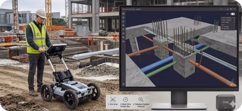
GPR (Ground Penetrating Radar) is a high-frequency electromagnetic method used to "see" through solid surfaces like concrete, soil, and asphalt. By sending radar pulses into the ground and measuring the reflected signals, Geo Scan 3D creates a detailed profile of what lies beneath the surface—all without a single drill or excavation.
We present to you the projects we have completed in the past with our experts in this field.
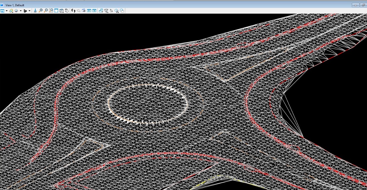
Millimeter precision for every industry. Geo Scan 3D delivers the world’s most accurate digital replicas and 3D
models for modern engineering and design processes.
%202.svg)
Precision detection of rebar, conduits, and post-tension (PT) cables before core drilling or concrete sawing.
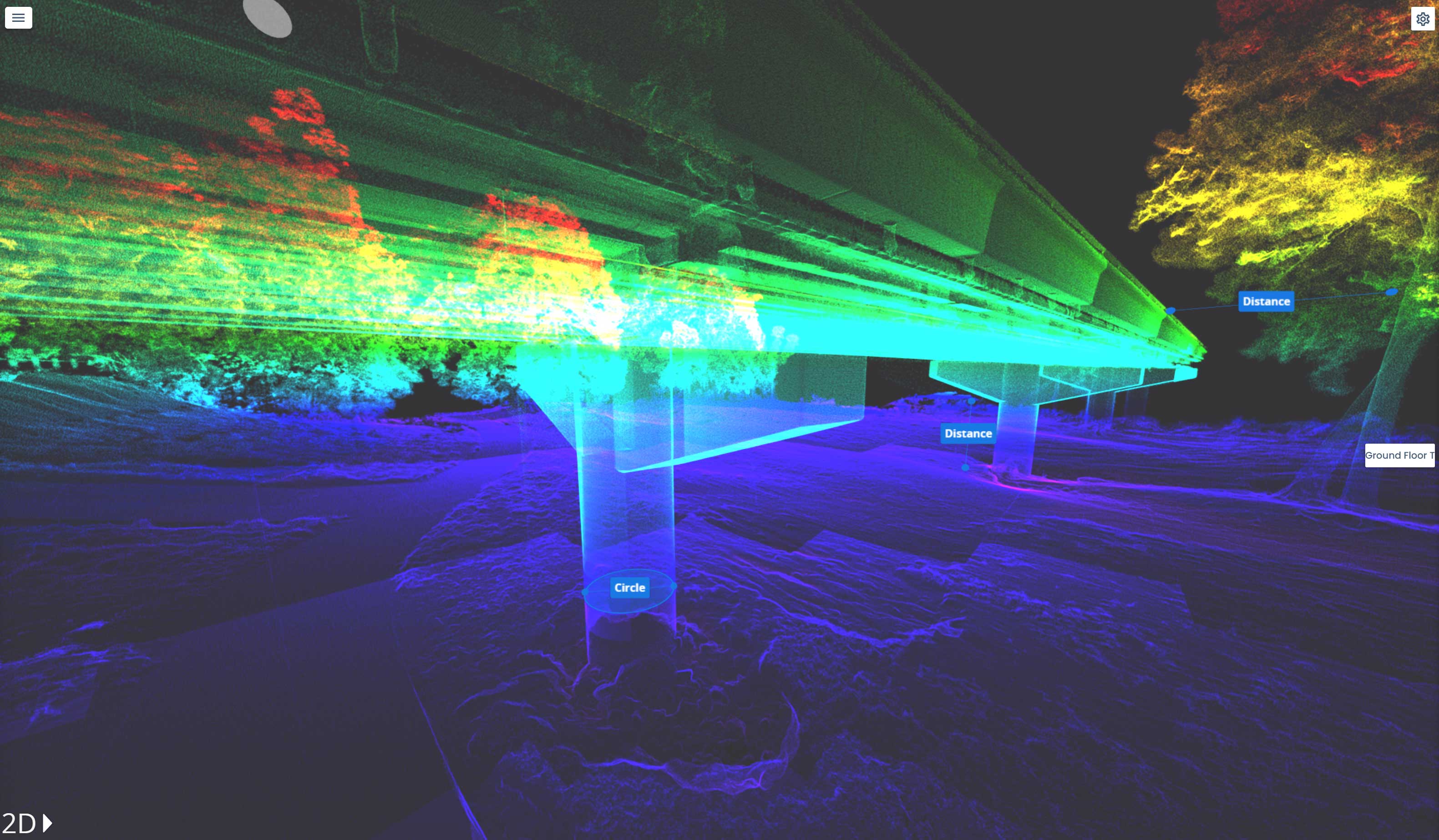
Assessing pavement thickness and identifying subsurface delamination or voids in bridges and tunnel
Locating non-metallic assets like PVC, fiberglass, and concrete pipes that traditional locators miss.
Rapid scanning of runways to detect hidden sinkholes and voids that threaten aircraft safety.
Mapping abandoned Underground Storage Tanks (USTs) and buried waste to mitigate development risks.
Non-invasive mapping of buried ruins, burial sites, to preserve history digitally.
Determining bedrock depth, mapping water tables, and locating abandoned mine shafts or tunnels.
Analyzing ballast fouling and identifying drainage issues beneath track beds without stopping rail traffic.
We're sharing the latest update with you. Follow us to stay informed about the updates.
In a world where speed, precision, and data are critical, at Geo Scan 3D we don't just scan;

The depth of penetration depends largely on the material’s conductivity and the frequency of the antenna used. In dry, cured concrete, our high-frequency scanners can reach depths of 50cm to 60cm with extreme detail. For geological or utility mapping in favorable soil conditions, our lower-frequency systems can penetrate up to 10 meters deep.
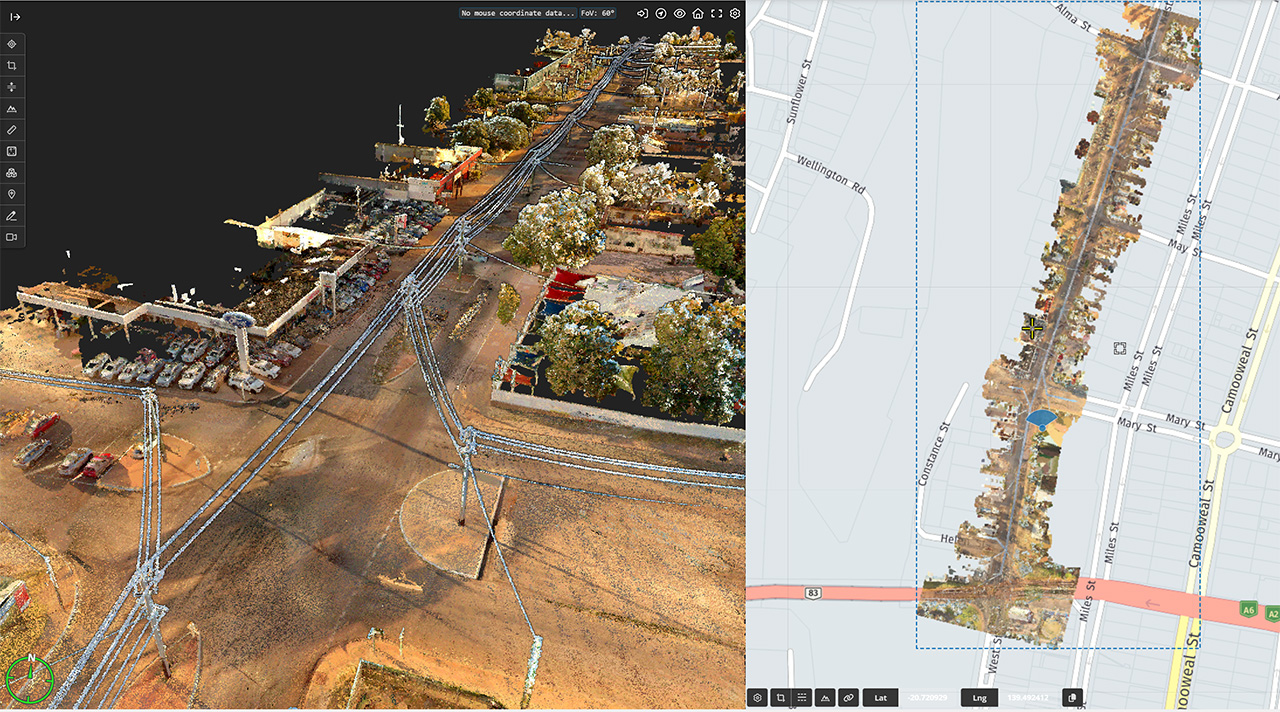
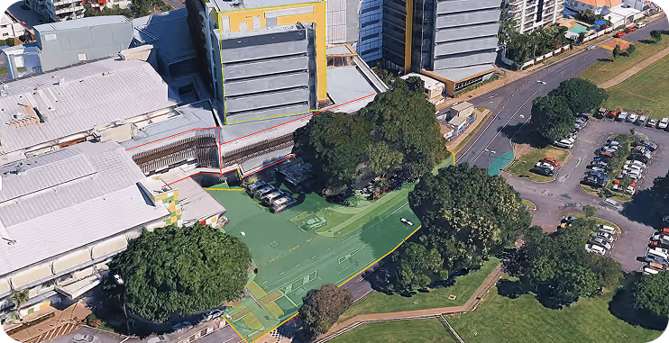
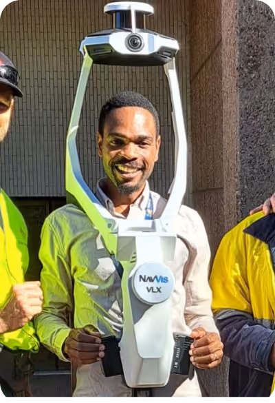
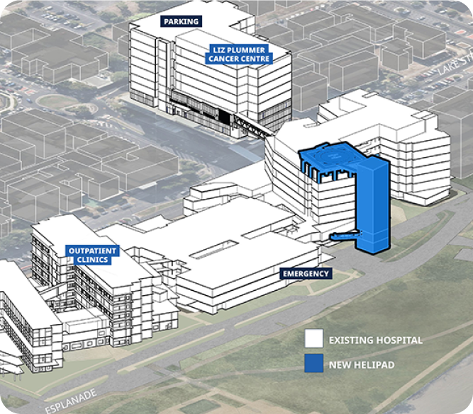
Our mobile laser scanning (NavVis VLX 3) achieves sub-5mm global accuracy. For even more sensitive requirements, we use control points to ensure professional-grade precision across large-scale sites.
Our mobile laser scanning (NavVis VLX 3) achieves sub-5mm global accuracy. For even more sensitive requirements, we use control points to ensure professional-grade precision across large-scale sites.
Our mobile laser scanning (NavVis VLX 3) achieves sub-5mm global accuracy. For even more sensitive requirements, we use control points to ensure professional-grade precision across large-scale sites.
Read MoreIn a world where speed, precision, and data are critical, at Geo Scan 3D we don't just scan; we take your
projects into the digital future. These are the core values that set us apart in the industry:

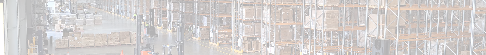
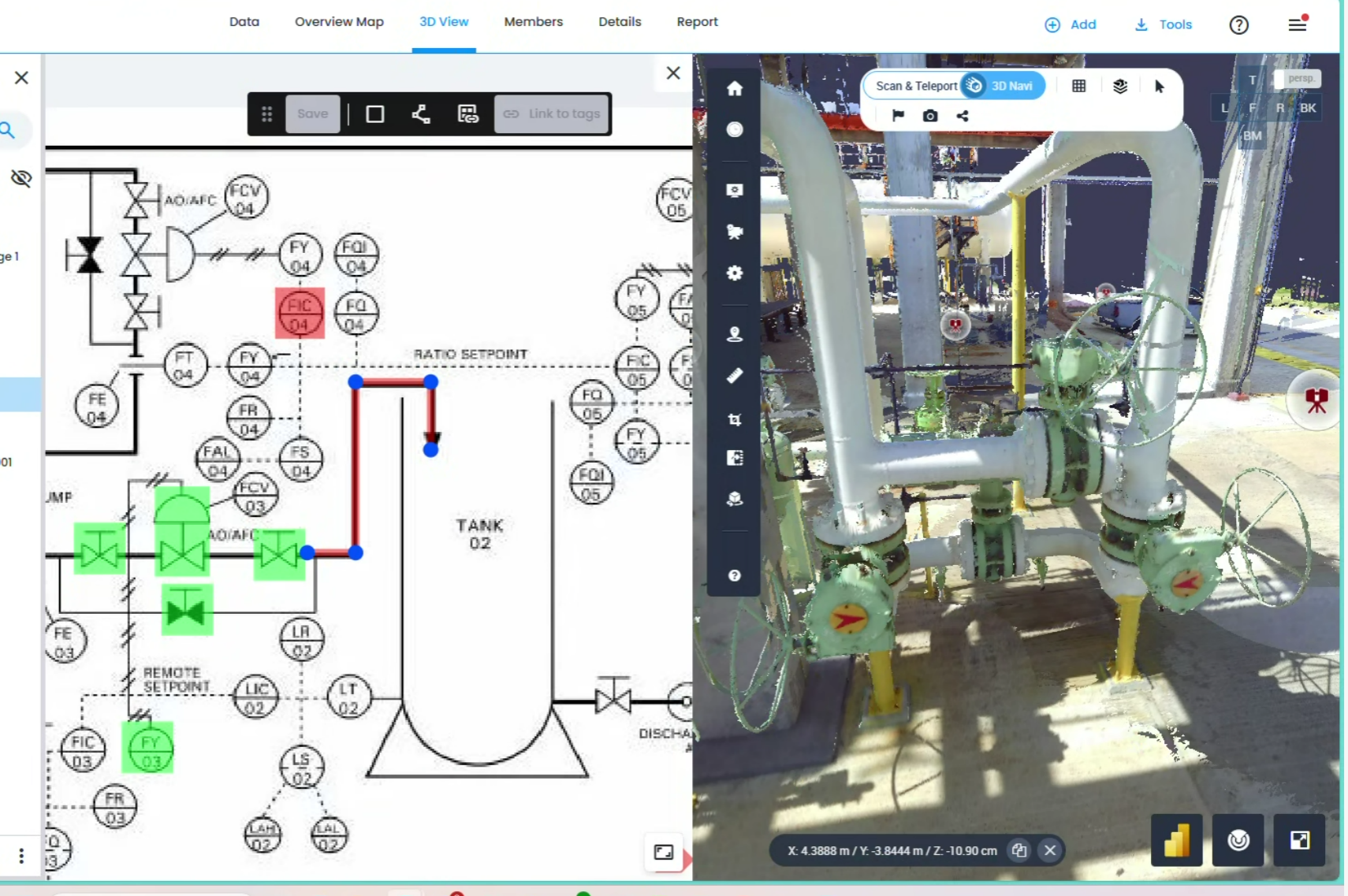
With our motto "One Scan, Multiple Solutions," we transform a single dataset from your site into numerous outputs such as Digital Twin, 3D Modeling, 2D Floor Plans, and Asset Tracking. This translates to both time and budget savings for our clients.
Our team, operating across Australia, is comprised not only of scanning specialists but also includes CASA-certified ReOC commercial drone operators and spatial data experts. We possess all the necessary expertise to conduct the most sensitive and secure operations on time on budget


.avif)


.avif)

.avif)
.avif)