

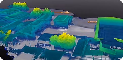
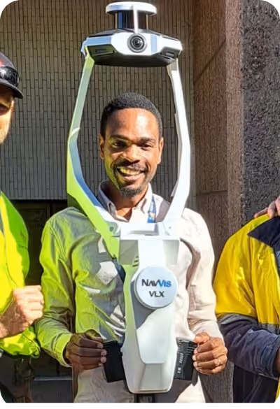
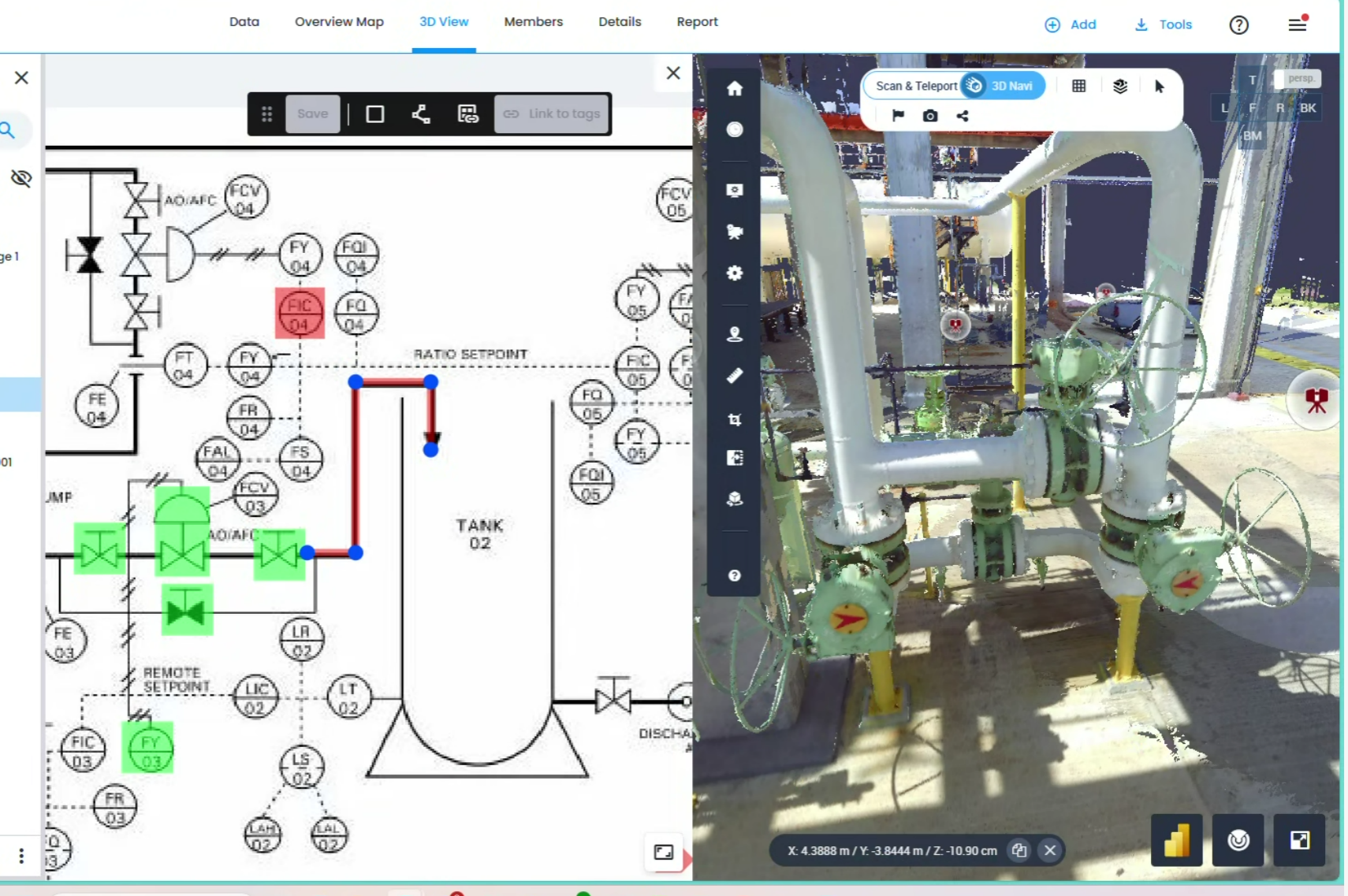
A Digital Twin is more than just a 3D model; it is a dynamic, detailed virtual replica of your physical assets. By integrating NavVis VLX 3 laser scanning technology, Geo Scan 3D creates an intelligent environment where every beam, pipe, and piece of machinery is captured with sub-5mm accuracy. This "Indoor Google Maps" experience allows stakeholders to conduct virtual site visits, perform remote measurements, and access real-time spatial data from any browser, eliminating the need for expensive on-site travel.
We present to you the projects we have completed in the past with our experts in this field.
Millimeter precision for every industry. Geo Scan 3D delivers the world’s most accurate digital replicas and 3D models for modern
engineering and design processes.
%202.svg)
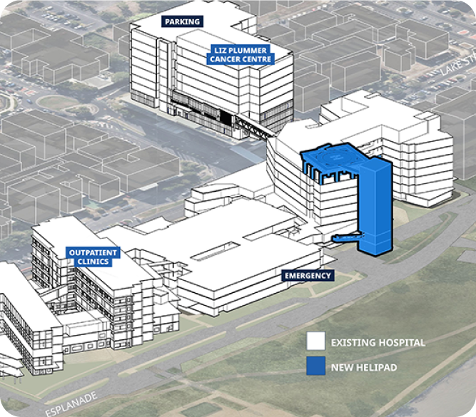
Precise planning for Major Renovations MEP (Mechanical, Electrical, Plumbing) management and as-built documentation.
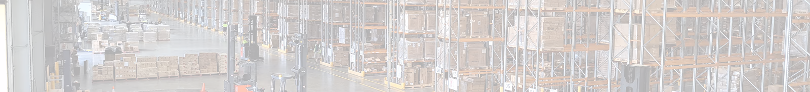
Remote asset tracking, space optimisation, and safety compliance.
Preservation of sacred sites and historic landmarks. Preserving them for generations Preserving History through Technology
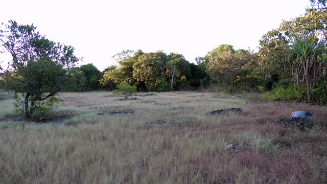
LiDAR and photogrammetry data collection of the terrain, vegetation and other features of the area..
Accurate loss adjustment, disaster recovery, and virtual tours. capture damaged area, and commence demo fast
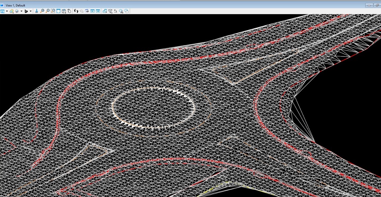
We can capture entire communities for housing developments, kerb & gutter planning sewer pipe planning
Precise scanning for sewer network upgrades WWTP & WTP planning. Cycle-ways and pedestrian pathway planning
Monitoring structural integrity of processing plants and conveyor systems in harsh, remote environments using sub-5mm precision.
We're sharing the latest update with you.
Follow us to stay informed about the updates.
In a world where speed, precision, and data are critical, at Geo Scan 3D we don't just scan;

A Digital Twin is not just a visual 3D model; it is an intelligent, high-fidelity virtual replica of a physical asset. Using Geo Scan 3D’s NavVis VLX 3 technology, our digital twins create a living ecosystem where you can navigate, take millimetre-accurate measurements, and link specific data to every asset—such as pipes, machinery, or panels—within the virtual space.
Our mobile laser scanning (NavVis VLX 3) achieves sub-5mm global accuracy. For even more sensitive requirements, we use control points to ensure professional-grade precision across large-scale sites.
Our mobile laser scanning (NavVis VLX 3) achieves sub-5mm global accuracy. For even more sensitive requirements, we use control points to ensure professional-grade precision across large-scale sites.
Our mobile laser scanning (NavVis VLX 3) achieves sub-5mm global accuracy. For even more sensitive requirements, we use control points to ensure professional-grade precision across large-scale sites.
Read MoreIn a world where speed, precision, and data are critical, at Geo Scan 3D we don't just scan; we take your
projects into the digital future. These are the core values that set us apart in the industry:

With our motto "One Scan, Multiple Solutions," we transform a single dataset from your site into numerous outputs such as Digital Twin, 3D Modeling, 2D Floor Plans, and Asset Tracking. This translates to both time and budget savings for our clients.
Our team, operating across Australia, is comprised not only of scanning specialists but also includes CASA-certified ReOC commercial drone operators and spatial data experts. We possess all the necessary expertise to conduct the most sensitive and secure operations on time on budget


.avif)


.avif)

.avif)
.avif)