
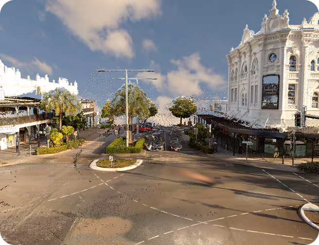
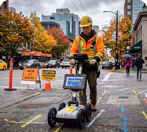
We supply local authorities and municipal departments with high-precision 3D geospatial data to optimize urban planning and infrastructure management.
Our scanning solutions provide a digital foundation for public safety assessments, road network analysis, and efficient utility mapping, ensuring that tax-funded projects are executed with maximum transparency and minimal waste. By digitizing the physical environment, we help councils transition into data-driven "Smart Cities" that serve their citizens more effectively.
Preserving cultural history requires more than just photographs; it demands a sub-millimetric digital record that captures the soul of a site.
GeoScan3D utilises advanced LiDAR and photogrammetry to create "Digital Twins" of historical landmarks above the surface ensuring that every intricate detail is archived against the threats of time and natural decay. These highly accurate models serve as the ultimate blueprint for restoration architects and historians, allowing for virtual tours and structural analysis without ever disturbing the subject.

We provide detailed 3D mapping and can do the feature extraction in house. many designers are not adapt at designing from point cloud data, so let us take the pain away. we can work direct with engineering teams, and deliver to their chosen format i.e 12D
Our scanning solutions provide a digital foundation for public safety assessments, road network analysis, and efficient utility mapping, ensuring that tax-funded projects are executed with maximum transparency and minimal waste. By digitizing the physical environment, we help councils transition into data-driven "Smart Cities" that serve their citizens more effectively.
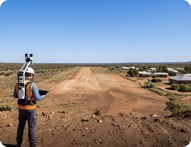
Bringing essential infrastructure to isolated or remote regions presents unique logistical challenges that traditional surveying cannot easily solve. Our mobile and aerial 3D scanning technologies allow for rapid terrain analysis and site surveying in difficult-to-reach locations, supporting the development of housing, water & sewerage infrastructure, and roadway with kerb and guttering. We bridge the geographical gap by providing engineering-grade data that allows stakeholders to plan and execute vital community projects from any location in the world.
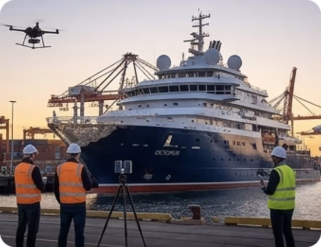
The maritime industry demands extreme precision due to the immense scale and harsh conditions of marine assets. GeoScan3D specialises in high-fidelity 3D scanning for mega yachts and commercial vessels, providing the critical data needed for hydrodynamic hull analysis, engine room retrofitting, and ballast water treatment system installations. Our "Digital Twin" approach for port infrastructure also allows for real-time monitoring of wharf conditions and land based structures, significantly reducing dry-dock time and operational downtime for shipowners
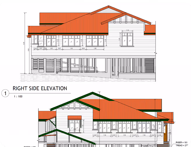
Heritage restoration of older properties ( that usually have no building plans) , the documentation process is often as important as the rebuild itself. Our non-invasive 3D scanning techniques allow owners and builders to record existing building in extreme detail. Capturing design features, dimensions, and site topography—accurately. These digital archives enable global collaboration, allowing experts to study 3D replicas of buildings from thousands of kilometres away, and provide a permanent record history prior to modern redevelopment.

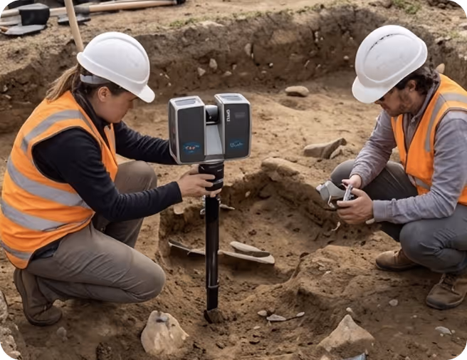
In the fields of archaeology and anthropology, the documentation process is often as important as the excavation itself. Our non-invasive 3D scanning techniques allow researchers to record findings in extreme detail—capturing textures, carvings, and site topography—without the risk of damaging fragile artifacts. These digital archives enable global collaboration, allowing experts to study 3D replicas of ancient sites from thousands of miles away, and provide a permanent record of human history that remains untouched by erosion or modern development.
Queensland is embarking on the biggest decade of infrastructure delivery in our history, with $89 billion to be invested over four years as part of Queensland’s Big Build. Building bike infrastructure that is separated from motor vehicles and meets the needs of all users, starts with LiDAR Scanning in preparation for the design team. We utilise high-resolution scanning to map existing and proposed pedestrian paths and bicycle lanes, identifying structural hazards, surface irregularities, and accessibility barriers for individuals with disabilities. This data-driven approach assists urban planners in designing safer crossings and smoother pathways.
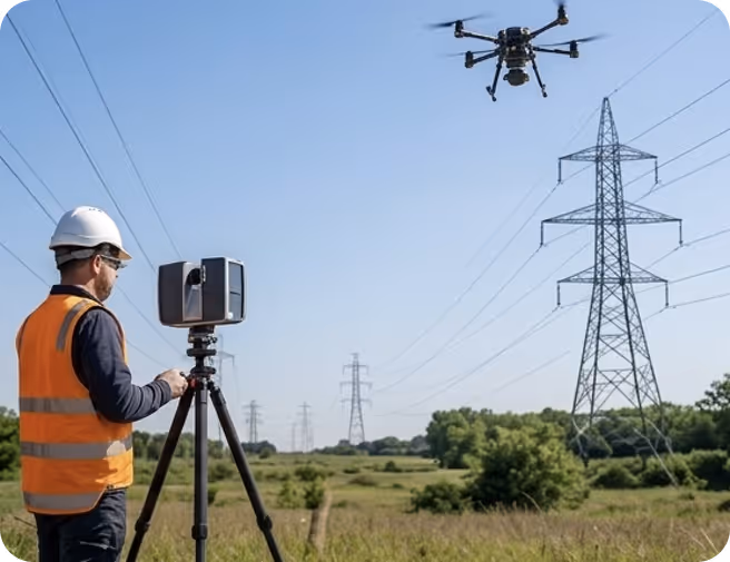
Ensuring a consistent energy supply depends on the rigorous monitoring of vast and often inaccessible power line networks. GeoScan3D utilizes advanced LiDAR and thermal imaging to monitor line clearance from encroaching vegetation and structural fatigue, providing utility companies with actionable reports to prevent outages and wildfires. Our 3D modeling capabilities allow for precise sag and tension calculations under various weather conditions, ensuring that vital energy infrastructure remains resilient and compliant with strict safety regulations.

With our motto "One Scan, Multiple Solutions," we transform a single dataset from your site into numerous outputs such as Digital Twin, 3D Modeling, 2D Floor Plans, and Asset Tracking. This translates to both time and budget savings for our clients.
Our team, operating across Australia, is comprised not only of scanning specialists but also includes CASA-certified ReOC commercial drone operators and spatial data experts. We possess all the necessary expertise to conduct the most sensitive and secure operations on time on budget


.avif)
.avif)