
Traditional surveying measures selected points-Geoscan3D captures complete environments.From buried utilities and underground infrastructure to airports, remote communities, industrial facilities and major infrastructure projects, our technology provides a comprehensive understanding of the world above and below the surface.We don't just collect data.We deliver intelligence.

Navigate your facilities remotely with our high-fidelity digital twins. Reduce site visits, enhance collaboration, and make confident decisions using a virtual replica accessible from any device.
Read More.avif)
Go beyond simple visuals with BIM-ready 3D models. Our ultra-dense point clouds provide the structural intelligence needed for complex engineering and architectural projects.
Read More.avif)
Generate precise as-built floor plans directly from our scan data. Faster and more cost-effective than traditional surveys, ensuring your documentation is always up to date.
Read More
Utilizing cutting-edge drone and LiDAR technology to map inaccessible or rough environments. Get high-resolution contour lines and digital terrain models with unparalleled speed.
Read More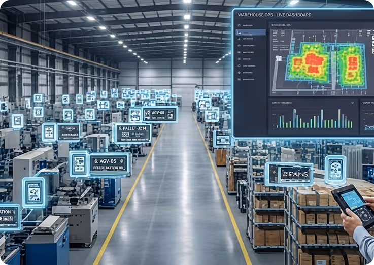
Create a live operating picture of your infrastructure. Link spatial data with asset registers to monitor conditions, schedule maintenance, and optimize life-cycle management.
Read More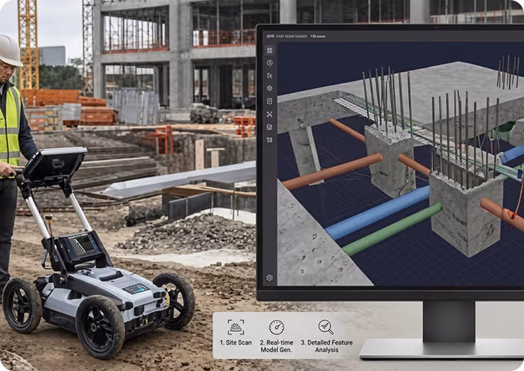
Locate underground utilities, rebar, and voids without excavation. Our PPK-integrated ground-penetrating radar ensures sub-centimetre accuracy for safety and site analysis.
Read More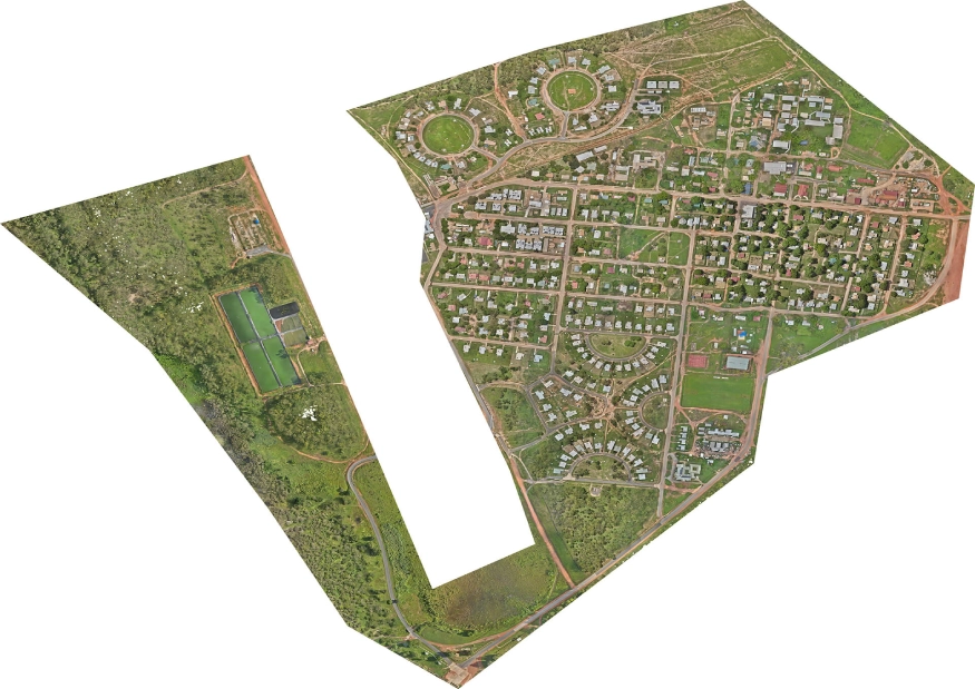
Traditional surveying measures points. Geoscan3D captures complete environments above ground, at ground level and below the surface. Cultural heritage preservation through the integration of advanced geospatial technologies, expert collaboration, and community engagement.
Read More
In a world where speed, precision, and data are critical, at Geo Scan 3D we don't just scan;

Our mobile laser scanning (NavVis VLX 3) achieves sub-5mm global accuracy. For even more sensitive requirements, we use control points to ensure professional-grade precision across large-scale sites.
Our mobile laser scanning (NavVis VLX 3) achieves sub-5mm global accuracy. For even more sensitive requirements, we use control points to ensure professional-grade precision across large-scale sites.
Our mobile laser scanning (NavVis VLX 3) achieves sub-5mm global accuracy. For even more sensitive requirements, we use control points to ensure professional-grade precision across large-scale sites.
Our mobile laser scanning (NavVis VLX 3) achieves sub-5mm global accuracy. For even more sensitive requirements, we use control points to ensure professional-grade precision across large-scale sites.
Read More
With our motto "One Scan, Multiple Solutions," we transform a single dataset from your site into numerous outputs such as Digital Twin, 3D Modeling, 2D Floor Plans, and Asset Tracking. This translates to both time and budget savings for our clients.
Our team, operating across Australia, is comprised not only of scanning specialists but also includes CASA-certified ReOC commercial drone operators and spatial data experts. We possess all the necessary expertise to conduct the most sensitive and secure operations on time on budget


.avif)
.avif)