
.avif)
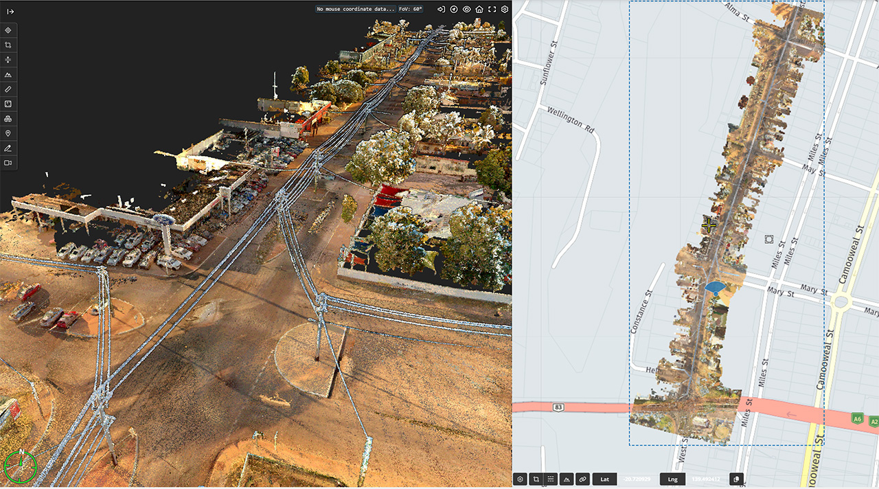
At Geo Scan 3D, we eliminate the human error of traditional tape measures. Our 2D Floor Plans are extracted directly from high-density LiDAR point clouds, ensuring that every wall, door, and fixture is positioned with absolute precision. We provide clear, straightforward, and cost-effective representations of your building’s layout. Whether you need plans for facilities management, real estate compliance, or renovation guidance, our documentation serves as a "single source of truth" for your property.
We present to you the projects we have completed in the past with our experts in this field.
Millimeter precision for every industry. Geo Scan 3D delivers the world’s most accurate digital replicas and 3D
models for modern engineering and design processes.
%202.svg)
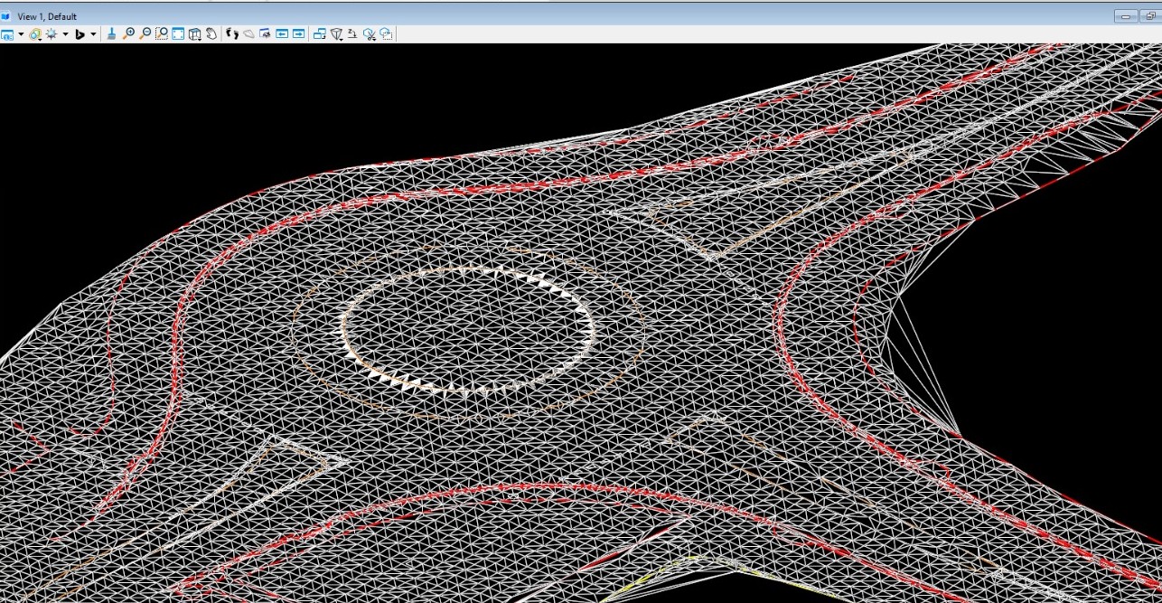
Precision terrain mapping for seamless highway, bridge, and rail corridor integration.
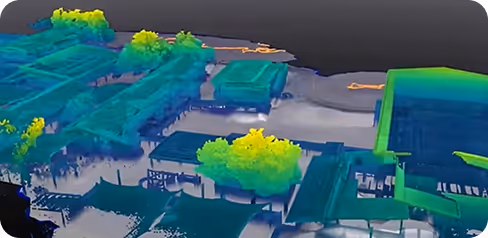
High-fidelity Digital Twins for advanced utility management and urban zoning.
Automated stockpile volumetrics and millimetric monitoring of pit wall stability.
Terrain analysis for optimal turbine placement and efficient drainage engineering.
Detailed site surveys enabling designs that harmonize with natural topography.
Fusing land-based LiDAR with underwater bathymetry for port and erosion analysis.
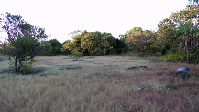
LiDAR "canopy penetration" to map hidden forest floors for ecological studies.
Micro-topographic data for precision irrigation and large-scale flood risk modeling.
We're sharing the latest update with you. Follow us to stay informed about the updates.
In a world where speed, precision, and data are critical, at Geo Scan 3D we don't just scan;

Traditional surveyors use manual tape measures or laser distance meters, which are prone to human error and cumulative discrepancies. Geo Scan 3D extracts floor plans directly from millions of LiDAR points. This "as-built" accuracy ensures that every nook, cranny, and structural deviation is captured exactly as it exists in reality.
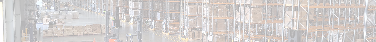
Our mobile laser scanning (NavVis VLX 3) achieves sub-5mm global accuracy. For even more sensitive requirements, we use control points to ensure professional-grade precision across large-scale sites.
Our mobile laser scanning (NavVis VLX 3) achieves sub-5mm global accuracy. For even more sensitive requirements, we use control points to ensure professional-grade precision across large-scale sites.
Our mobile laser scanning (NavVis VLX 3) achieves sub-5mm global accuracy. For even more sensitive requirements, we use control points to ensure professional-grade precision across large-scale sites.
Read MoreIn a world where speed, precision, and data are critical, at Geo Scan 3D we don't just scan; we take your
projects into the digital future. These are the core values that set us apart in the industry:

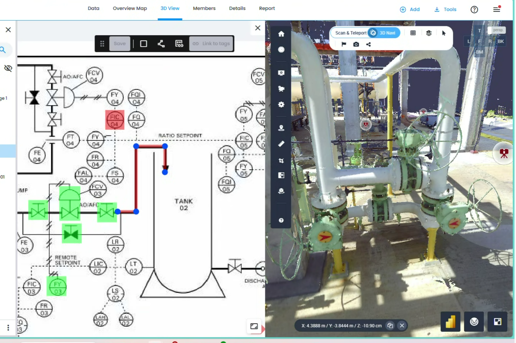
With our motto "One Scan, Multiple Solutions," we transform a single dataset from your site into numerous outputs such as Digital Twin, 3D Modeling, 2D Floor Plans, and Asset Tracking. This translates to both time and budget savings for our clients.
Our team, operating across Australia, is comprised not only of scanning specialists but also includes CASA-certified ReOC commercial drone operators and spatial data experts. We possess all the necessary expertise to conduct the most sensitive and secure operations on time on budget


.avif)


.avif)

.avif)
.avif)