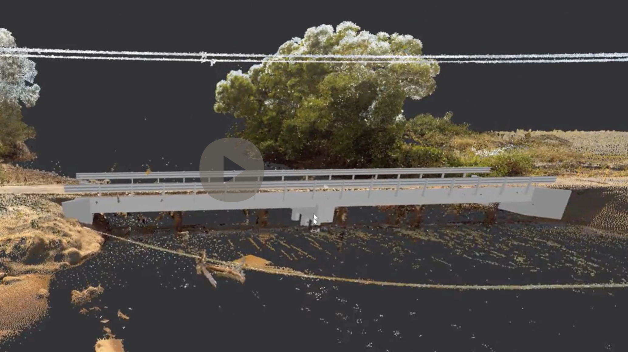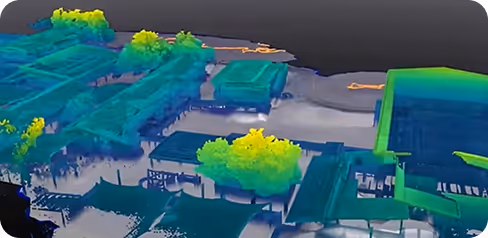
From a single scan of a Cairns Hospital to a complete digital twin model — our deliverables are built for how modern teams work: remote, collaborative, and data-driven.

Transform your physical assets into immersive, high-definition digital twins.

Secure your project’s future with comprehensive and detailed reality capture data.
Transform your physical assets into immersive, high-definition digital twins.
Secure your project’s future with comprehensive and detailed reality capture data.
Lirigo Platformu, girişimcilerin başarılı olmasına yardımcı olmak için dijital yapay zeka araçlarını deneyimli insan mentorluğuyla birleştirir. Bu model, stratejik rehberlik ve teknolojik çözümler aracılığıyla işletmelerin sağlam temeller üzerinde büyümesini sağlar.
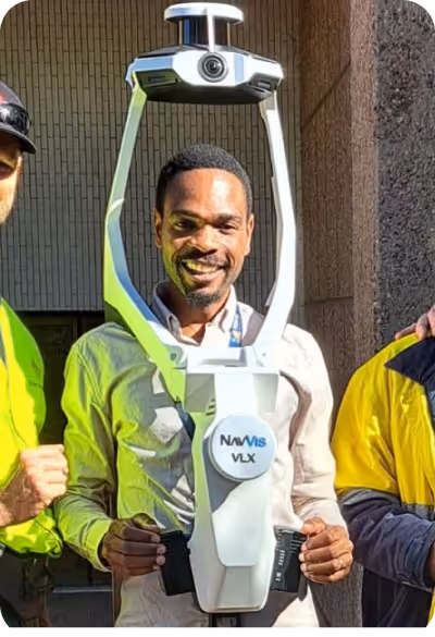
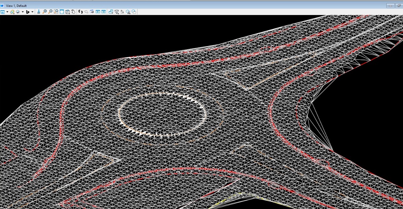
Fast. Accurate. No BS. We fly to your site anywhere in Australia and get the scan done
then deliver web-ready outputs your whole team can use without specialised software.
01

02

03

04
Fast. Accurate. No BS. We fly to your site anywhere in Australia and get the scan done
then deliver web-ready outputs your whole team can use without specialised software.
We wanted to share the results we obtained from our projects with you through videos.
Fast. Accurate. No BS. We fly to your site anywhere in Australia and get the scan done then deliver web-ready outputs your whole team can use without specialised software.
Remote Asset Management and Real-Time Monitoring
Digital twins create a virtual copy of a city's physical infrastructure (roads, bridges, water networks, lighting systems). This allows municipal teams to monitor the status of thousands of assets from a single center.
Preventive Maintenance: Data from sensors can remotely detect when a water pipe is about to leak before bursting or when a street lamp is nearing the end of its lifespan.
Inventory Tracking: Without the need for a physical count, all assets owned by the city can be listed digitally with their coordinates and technical specifications.

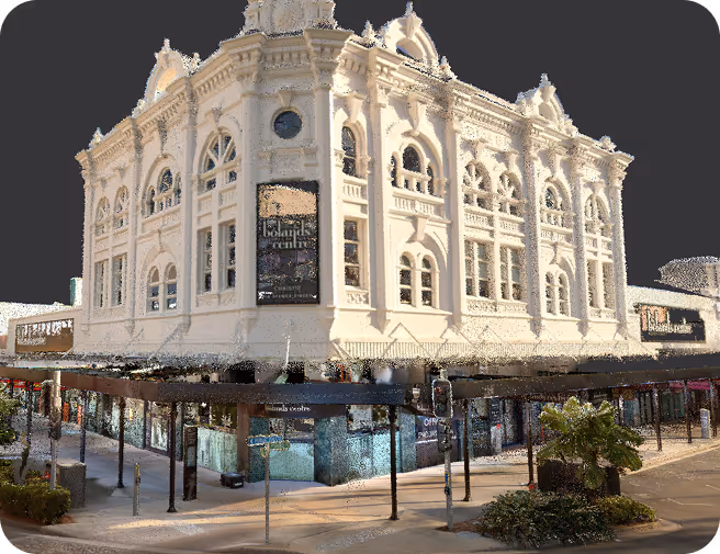
Digital Documentation and Conservation of Cultural Assets
Digital twins create highly detailed virtual replicas of historical sites, monuments, and culturally significant environments. This enables conservation teams to analyze, monitor, and preserve heritage assets without constant physical intervention.
Condition Monitoring: High-resolution data and periodic scans allow experts to detect structural changes, material degradation, or environmental impacts before irreversible damage occurs.
Archival and Restoration Planning: Accurate digital records provide a reliable reference for restoration projects, ensuring that original architectural details and historical integrity are maintained over time.
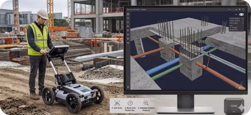
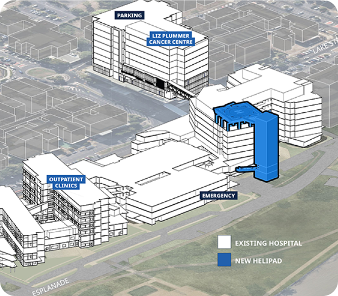
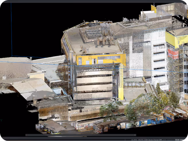
Read MoreFacility Digitization and Smart Hospital Management
Digital twins create a virtual model of healthcare facilities, including hospital buildings, equipment, and patient flow systems. This allows administrators to oversee operations, optimize resources, and improve service delivery from a centralized platform.
Operational Efficiency: Real-time data helps track equipment usage, bed availability, and staff allocation, enabling faster decision-making and reduced waiting times.
Predictive Maintenance and Safety: Medical devices and critical infrastructure can be monitored continuously to detect potential failures early, ensuring uninterrupted care and enhancing patient safety.
Read MoreDigital Access and Infrastructure Visibility
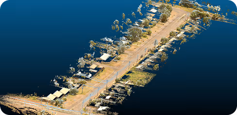
Digital twins create a virtual representation of remote settlements, including housing, utilities, and transportation networks. This enables authorities and service providers to understand, monitor, and manage infrastructure without frequent on-site presence.
Service Planning: Accurate spatial data helps optimize the delivery of essential services such as water, electricity, healthcare, and education, even in hard-to-reach areas.
Sustainable Development and Maintenance: Ongoing monitoring allows early identification of infrastructure issues and supports long-term planning for resilient and sustainable community growth.
Read MoreSmart Port Operations and Maritime Infrastructure Management
Digital twins create a real-time virtual model of ports, harbors, and marine assets, including docks, vessels, cargo areas, and navigation channels. This enables port authorities to monitor operations, improve coordination, and enhance overall efficiency from a centralized system.
Traffic and Logistics Optimization: Live data allows better scheduling of vessel movements, cargo handling, and berth allocation, reducing delays and increasing throughput.
Infrastructure Monitoring and Safety: Continuous tracking of structural conditions and environmental factors helps detect potential risks early, ensuring safer operations and extending the lifespan of critical marine assets.
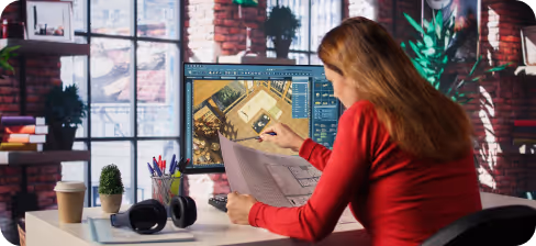
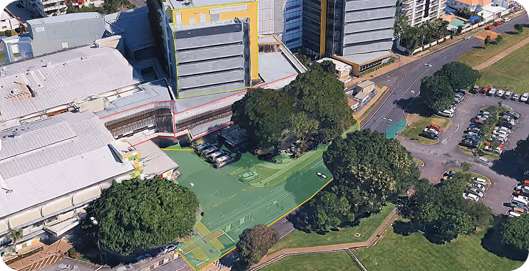
Read MoreDesign Visualization and Project Lifecycle Management
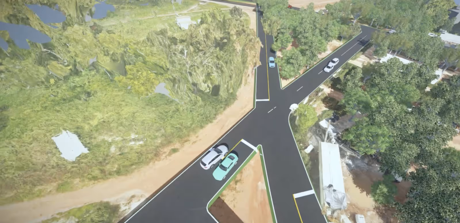
Digital twins create interactive, data-rich models of buildings and developments, allowing architects and developers to visualize, test, and refine designs before construction begins. This supports better collaboration and more informed decision-making throughout the project lifecycle.
Design Optimization: Real-time simulations help evaluate spatial layouts, materials, and environmental performance, enabling more efficient and sustainable design choices.
Construction Planning and Coordination: Accurate digital models streamline communication between stakeholders, reduce errors on-site, and ensure projects are delivered on time and within budget.
Read MoreDigital Reconstruction and Cultural Analysis.
Digital twins create a virtual copy of a city's physical infrastructure (roads, bridges, water networks, lighting systems). This allows municipal teams to monitor the status of thousands of assets from a single center.
Site Documentation and Preservation: High-resolution scans capture fragile structures and artifacts in detail, allowing continuous study while protecting them from environmental or human damage.
Research Collaboration and Interpretation: Shared digital models support interdisciplinary collaboration, helping experts compare findings, reconstruct historical narratives, and gain deeper insights into past human societies.
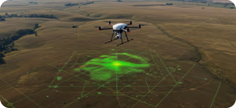
Read MoreSmart Planning and Infrastructure Optimization
Digital twins create a virtual copy of a city's physical infrastructure (roads, bridges, water networks, lighting systems). This allows municipal teams to monitor the status of thousands of assets from a single center.
Usage and Flow Analysis: Real-time and historical data help identify high-traffic areas, peak usage times, and potential bottlenecks, supporting better route planning and capacity management.
Safety and Maintenance Monitoring: Continuous tracking of surface conditions, lighting systems, and environmental factors enables early detection of issues, ensuring safer and more comfortable mobility experiences.
Read MoreNetwork Visibility and Fault Detection
Digital twins create a comprehensive virtual model of electricity distribution networks, including power lines, substations, and connected infrastructure. This enables utility providers to monitor system performance, identify issues, and manage operations more efficiently from a centralized platform.
Fault Detection and Response: Real-time data allows rapid identification of outages, overloads, or damaged lines, helping teams respond quickly and minimize service disruptions.
Asset Tracking and Maintenance Planning: Detailed digital records support proactive maintenance, optimize inspection schedules, and extend the lifespan of critical electrical infrastructure.
Read More
We're sharing the latest update with you.
Follow us to stay informed about the updates.
In a world where speed, precision, and data are critical, at Geo Scan 3D we don't just scan; we take your projects into the digital future. These are the core values that set us apart in the industry:
With our motto "One Scan, Multiple Solutions," we transform a single dataset from your site into numerous outputs such as Digital Twin, 3D Modeling, 2D Floor Plans, and Asset Tracking. This translates to both time and budget savings for our clients.
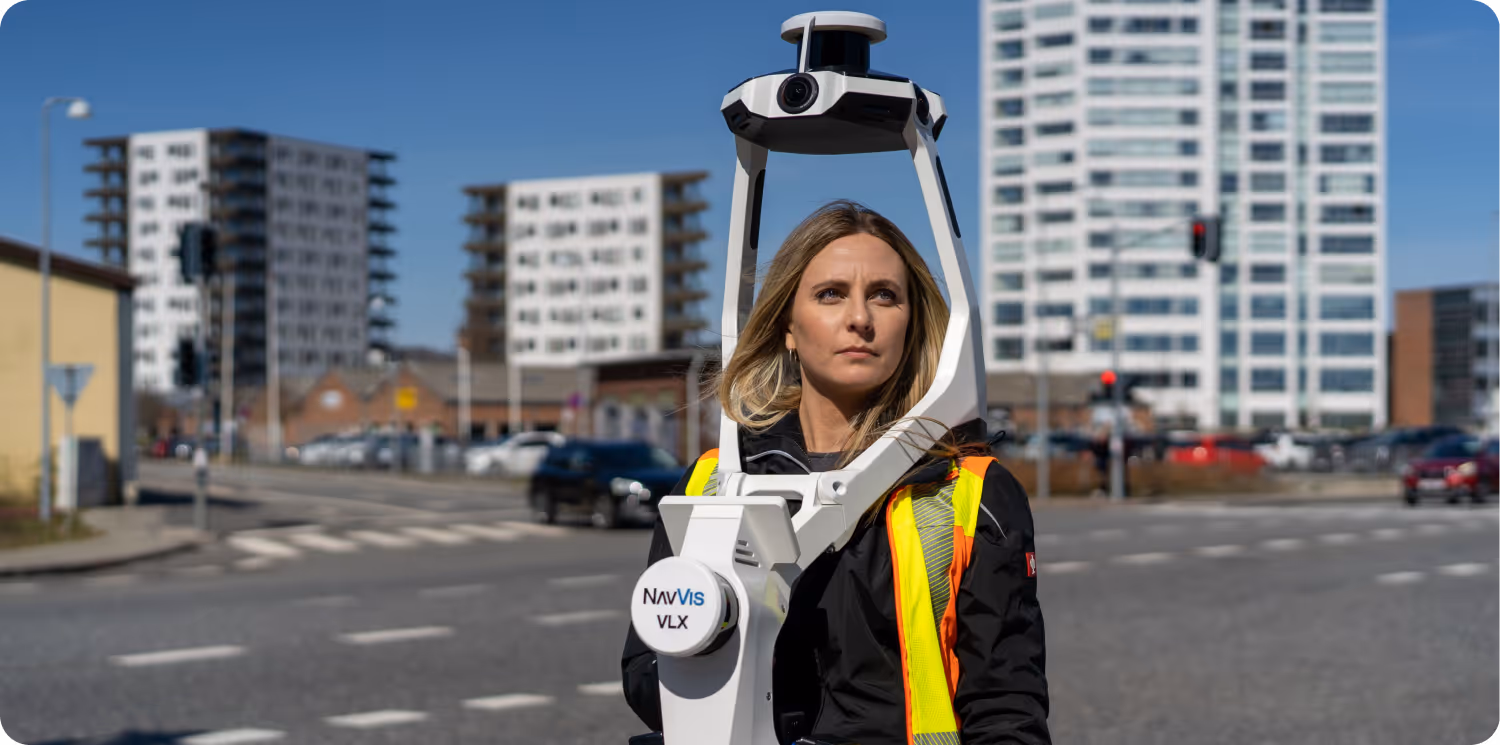
Our team, operating across Australia, is comprised not only of scanning specialists but also includes CASA-certified ReOC commercial drone operators and spatial data experts. We possess all the necessary expertise to conduct the most sensitive and secure operations on time on budget