

Asset Tracking is the process of documenting, locating, and monitoring physical assets—ranging from industrial machinery and utility poles to entire building infrastructures—using high-precision spatial data. Unlike traditional inventory lists, Geo Scan 3D’s approach creates a Geospatial Inventory, where every asset is tagged with its exact 3D coordinates, condition, and technical specifications.
We present to you the projects we have completed in the past with our experts in this field.
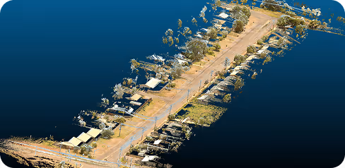
Millimeter precision for every industry. Geo Scan 3D delivers the world’s most accurate digital replicas and 3D
models for modern engineering and design processes.
%202.svg)
Precise monitoring of power poles, insulators, and vegetation encroachment for grid reliability
Real-time tracking of rolling stock, shipping containers, and yard equipment locations.
Digital mapping and condition monitoring of pipelines, valves, and pressurized vessels.
Automated management of street furniture, signage, and public lighting infrastructure.
Geospatial inventory of towers, antennas, and fiber optic junction boxes.
Tracking high-value machinery, spare parts, and production line layouts for optimization.
Monitoring HVAC systems, fire safety equipment, and structural assets in large complexes
Real-time location and maintenance tracking of heavy machinery and mobile plant assets
Asset management of expensive medical equipment and mobile diagnostic units across hospitals
Monitoring the location and utilization of heavy plant equipment and onsite materials.
High-security tracking of tactical assets and facility infrastructure in sensitive zones.
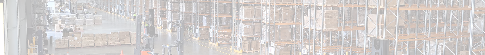
3D mapping of racking systems and automated inventory tracking in giant distribution center
We're sharing the latest update with you. Follow us to stay informed about the updates.
In a world where speed, precision, and data are critical, at Geo Scan 3D we don't just scan;

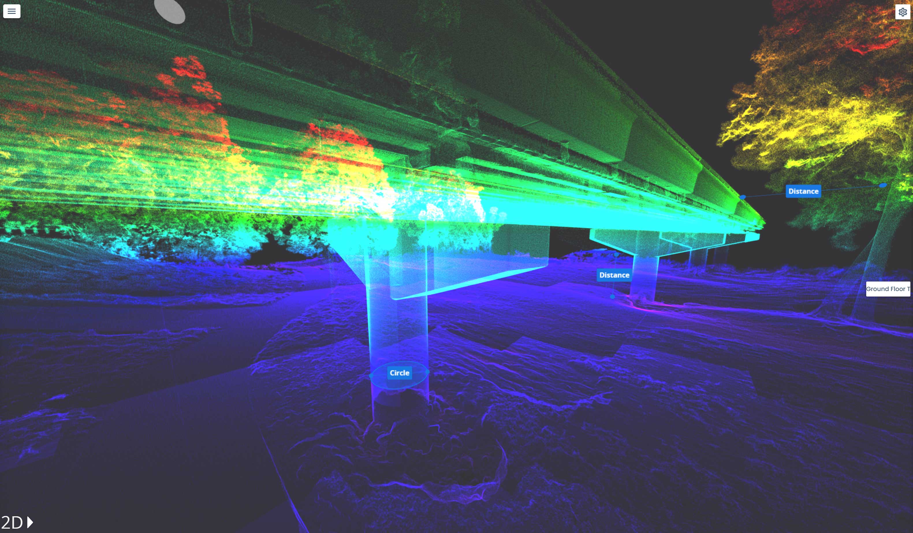
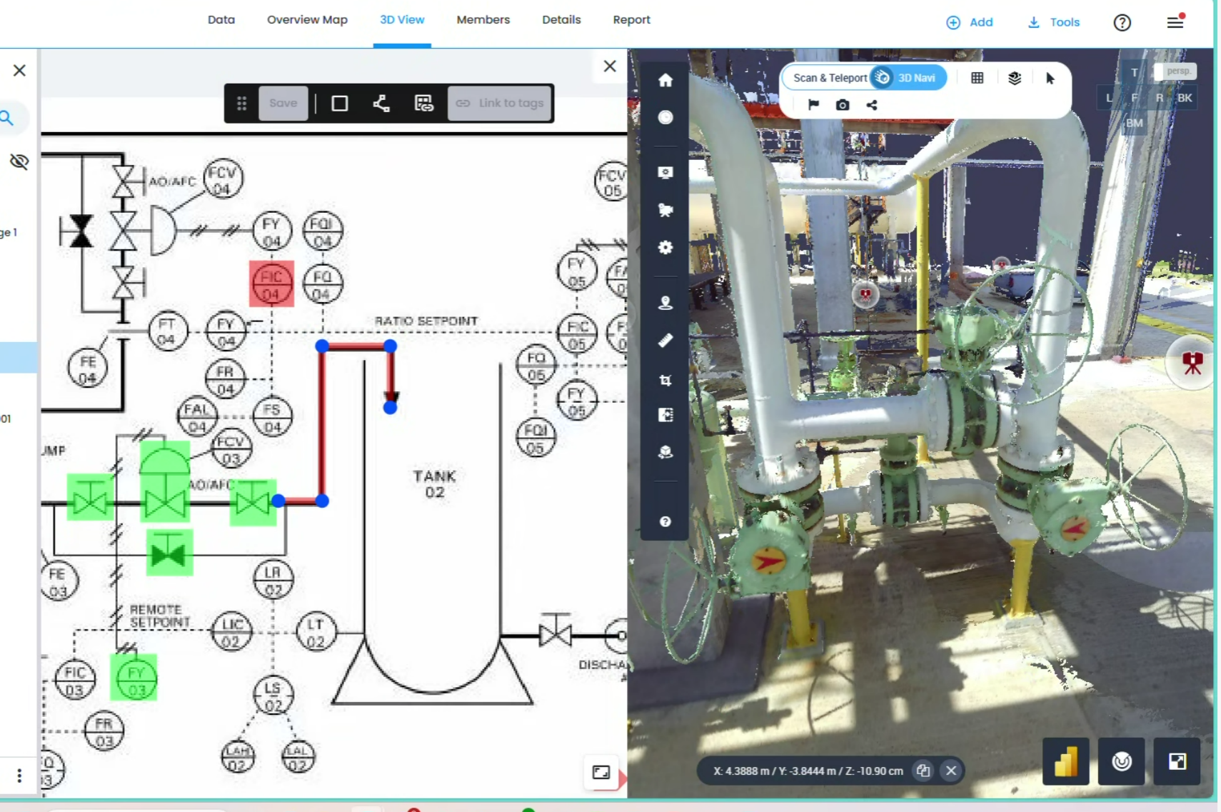
Geo Scan 3D expertise ensures that the bridge between "raw field data" and "actionable office intelligence" is seamless. We don't just hand over a file; we provide a structured dataset designed for your specific platform's logic.
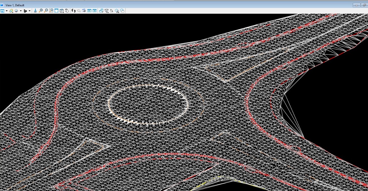
Our mobile laser scanning (NavVis VLX 3) achieves sub-5mm global accuracy. For even more sensitive requirements, we use control points to ensure professional-grade precision across large-scale sites.
Our mobile laser scanning (NavVis VLX 3) achieves sub-5mm global accuracy. For even more sensitive requirements, we use control points to ensure professional-grade precision across large-scale sites.
Our mobile laser scanning (NavVis VLX 3) achieves sub-5mm global accuracy. For even more sensitive requirements, we use control points to ensure professional-grade precision across large-scale sites.
Read MoreIn a world where speed, precision, and data are critical, at Geo Scan 3D we don't just scan; we take your
projects into the digital future. These are the core values that set us apart in the industry:

With our motto "One Scan, Multiple Solutions," we transform a single dataset from your site into numerous outputs such as Digital Twin, 3D Modeling, 2D Floor Plans, and Asset Tracking. This translates to both time and budget savings for our clients.
Our team, operating across Australia, is comprised not only of scanning specialists but also includes CASA-certified ReOC commercial drone operators and spatial data experts. We possess all the necessary expertise to conduct the most sensitive and secure operations on time on budget


.avif)


.avif)

.avif)
.avif)