01
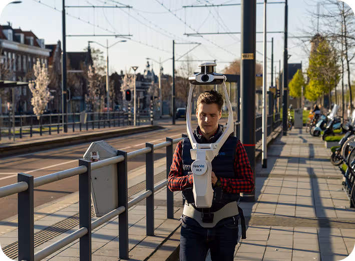
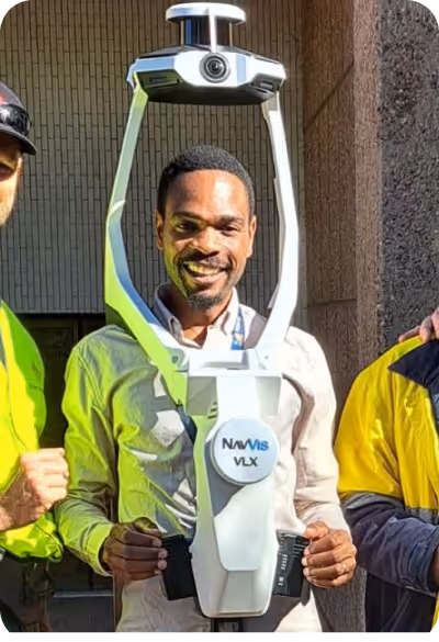
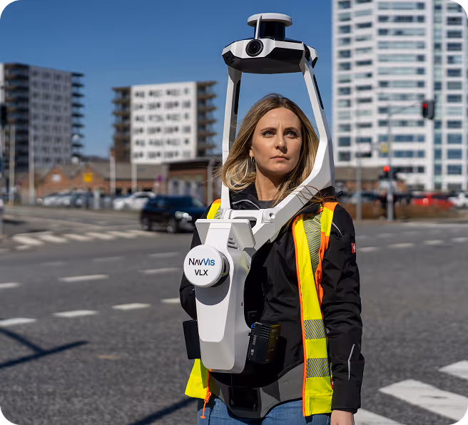
The process begins at your project location. Unlike traditional methods, we digitise your spaces dynamically using the NavVis VLX3, one of the world’s most advanced mobile mapping systems
Mobility and Speed:
Without wasting time on static tripod setups, our operator captures data by walking through the site. This allows for scanning large areas up to 90% faster.
High Precision
Every surface is captured with sub-5mm precision, ensuring a high-fidelity digital representation.
Comprehensive Data Collection
We record not only structural data but also 360-degree panoramic imagery and spatial metadata simultaneously.

01
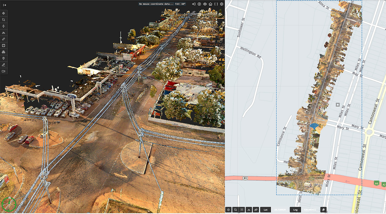
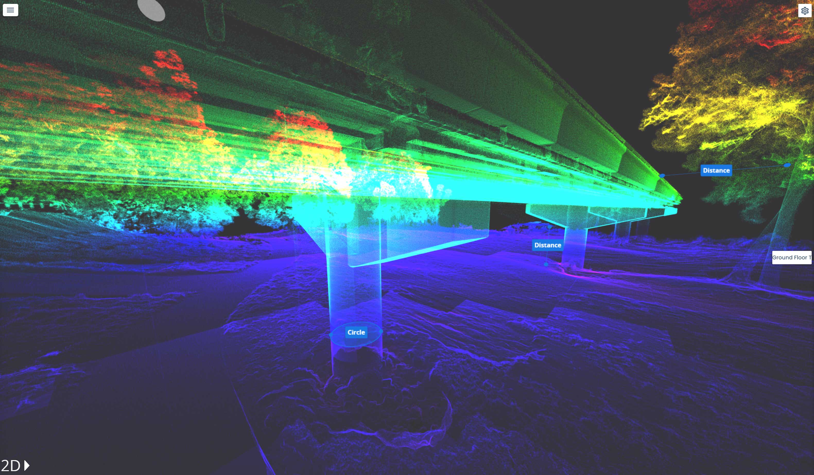
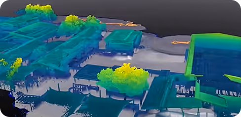
The raw data collected from the field is processed by our engineering team to make it meaningful. This stage forms the "brain" of your digital twin.
Point Cloud Generation
LiDAR data is overlaid with high-resolution panoramic photos. This allows you to not only take measurements in the digital environment but also see the actual visual reality.
Image Integration
Every surface is captured with sub-5mm precision, ensuring a high-fidelity digital representation.
Alignment and Cleaning
Data from different floors or sections are perfectly unified within a single coordinate system.

03
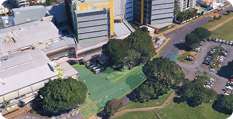
Processed data is converted into specific formats required for your project. We don't just provide raw data; we deliver results that can be directly integrated into your workflow.
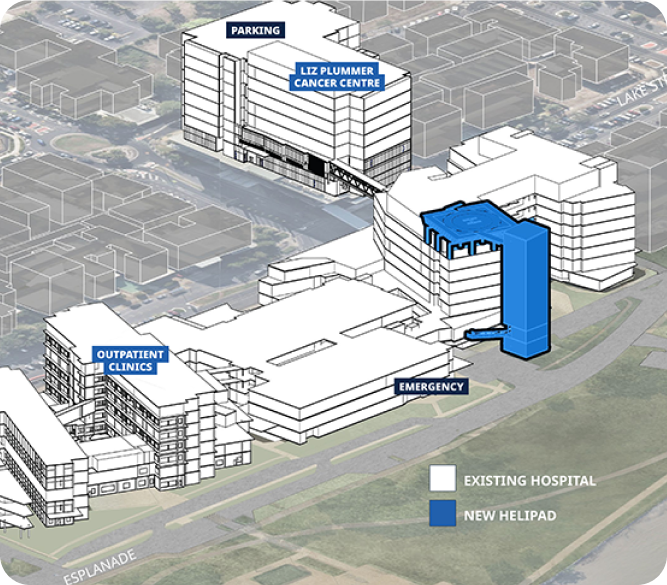
Digital Twins and BIM
3D models of existing conditions (As-Built) and BIM (Building Information Modeling) files
2D Floor Plans and Sections
High-accuracy floor plans, elevations, and sections for architectural projects.
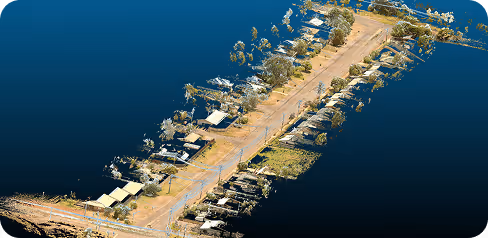
Topographic Maps
Essential geospatial data for land and site planning.

04
The best data is the data that can be used. We provide our deliverables on a platform where you can share them with your entire team without the need for any complex software installation.
Cloud-Based Platform
Access your project from anywhere in the world, simply through a web browser.
Zero Installation Cost
Stakeholders without specialised CAD software can navigate through the scan data, take measurements, and add annotations.
Secure Storage
All your data is stored on high-security servers and is instantly viewable by authorised team members
we meet and exceed the data sovereignty laws that councils and communities demand. read more here
Fast. Accurate. No BS. We fly to your site anywhere in Australia and get the scan done
then deliver web-ready outputs your whole team can use without specialised software.
In a world where speed, precision, and data are critical, at Geo Scan 3D we don't just scan; we take your
projects into the digital future. We also offer an end to end solution in managing your data if needed.

With our motto "One Scan, Multiple Solutions," we transform a single dataset from your site into numerous outputs such as Digital Twin, 3D Modeling, 2D Floor Plans, and Asset Tracking. This translates to both time and budget savings for our clients.
Our team, operating across Australia, is comprised not only of scanning specialists but also includes CASA-certified ReOC commercial drone operators and spatial data experts. We possess all the necessary expertise to conduct the most sensitive and secure operations on time on budget


.avif)