
.avif)
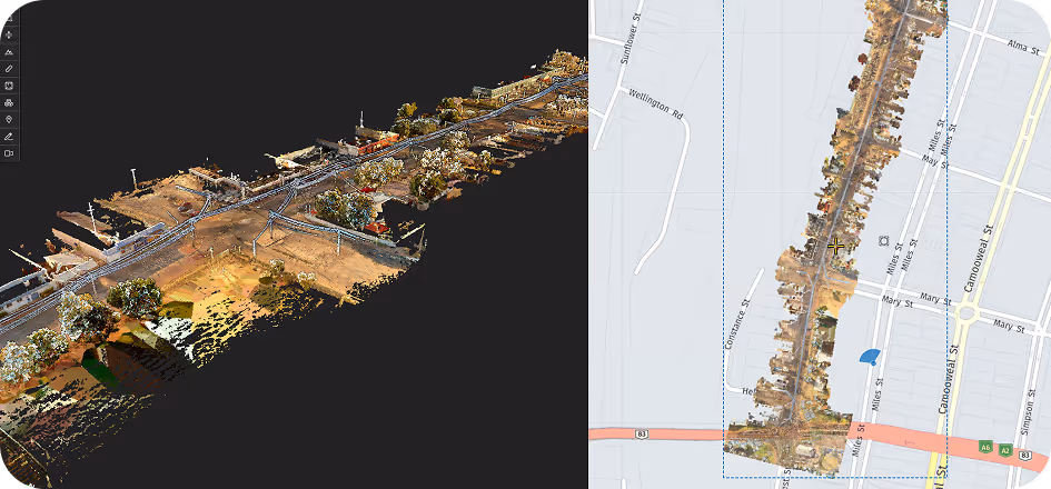
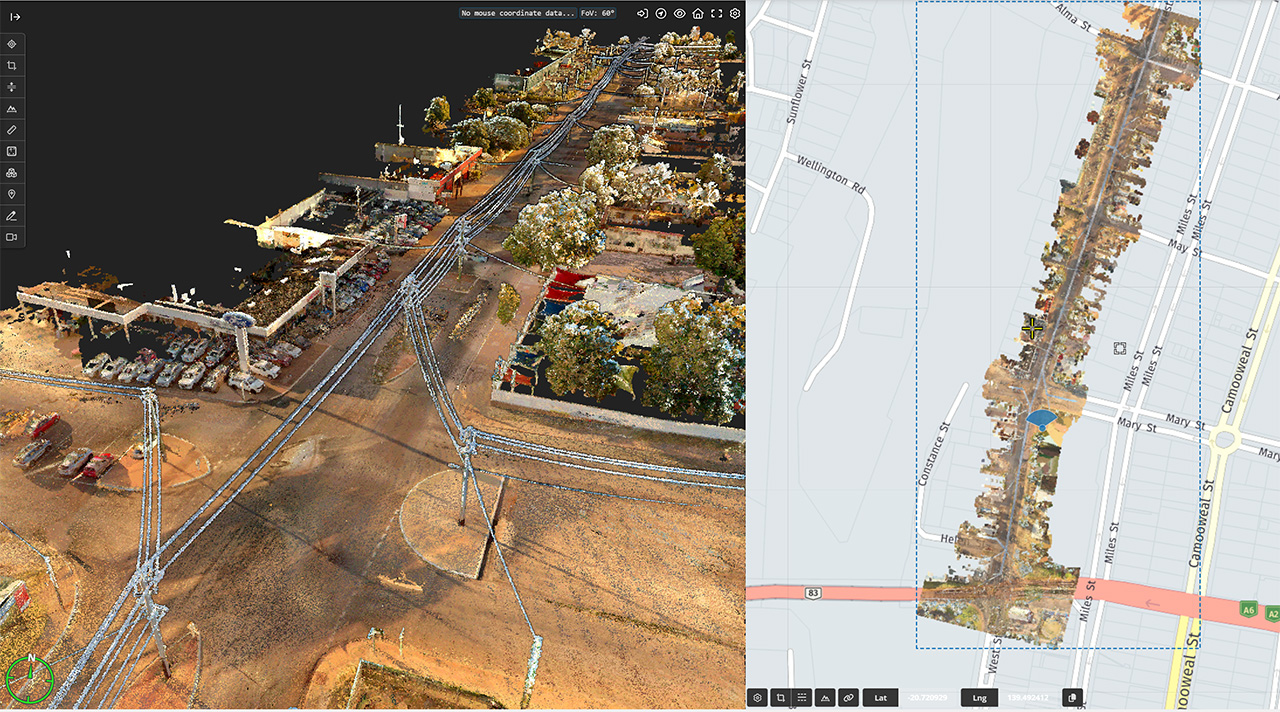
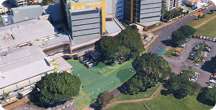
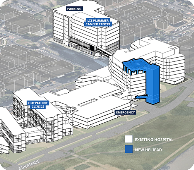
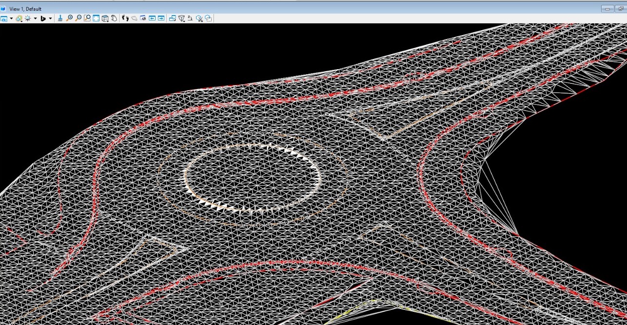
At Geo Scan 3D, we don't just capture images; we capture reality with scientific precision. Our Advanced LiDAR (Light Detection and Ranging) services utilise the NavVis VLX 3 and high-end sensors to generate ultra-dense point clouds. We specialise in transforming these massive datasets into "BIM-ready" 3D models. Whether it’s a complex industrial plant or a heritage site, our modeling expertise ensures that every structural element is documented with its exact dimensions, materials, and spatial relationships.
We present to you the projects we have completed in the past with our experts in this field.
Millimeter precision for every industry. Geo Scan 3D delivers the world’s most accurate digital replicas and 3D
models for modern engineering and design processes.
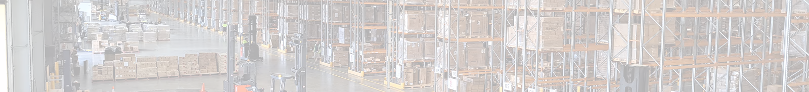
Geo Scan 3D, we don't just capture images; we capture reality with scientific precision. Our Advanced GPR scans concretes floor slabs at shallow depths to detect and quantify slab delamination in floor plates. We have scanned thousands of square meters of floor plates on large government projects.
We can quantify to amount of delamination and transfer this into heat maps for insurance or engineering assessment.
We're sharing the latest update with you. Follow us to stay informed about the updates.
In a world where speed, precision, and data are critical, at Geo Scan 3D we don't just scan;

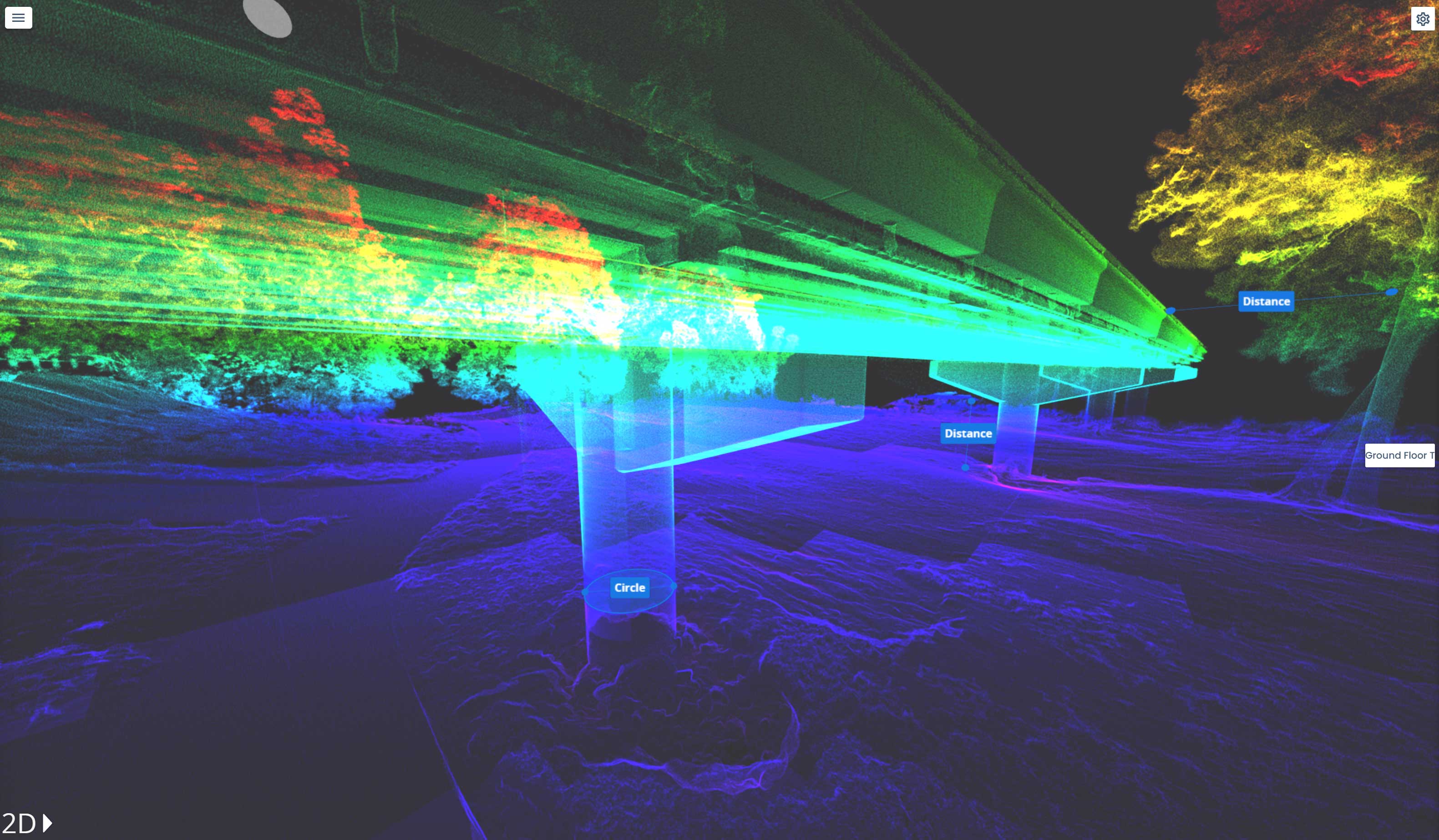
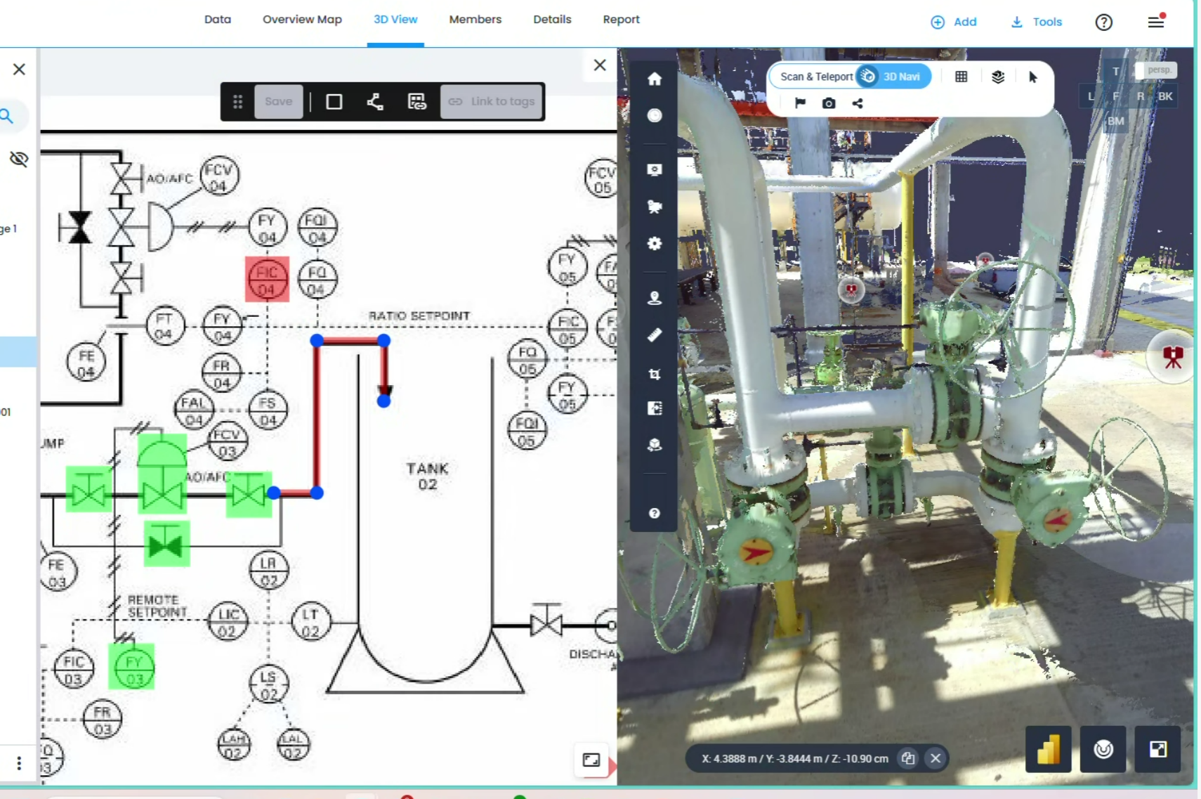
Yes. We specialize in "Scan-to-BIM," where we model complex MEP (Mechanical, Electrical, Plumbing) systems into intelligent 3D objects with specific metadata.
Our mobile laser scanning (NavVis VLX 3) achieves sub-5mm global accuracy. For even more sensitive requirements, we use control points to ensure professional-grade precision across large-scale sites.
Our mobile laser scanning (NavVis VLX 3) achieves sub-5mm global accuracy. For even more sensitive requirements, we use control points to ensure professional-grade precision across large-scale sites.
Our mobile laser scanning (NavVis VLX 3) achieves sub-5mm global accuracy. For even more sensitive requirements, we use control points to ensure professional-grade precision across large-scale sites.
Read MoreIn a world where speed, precision, and data are critical, at Geo Scan 3D we don't just scan; we take your
projects into the digital future. These are the core values that set us apart in the industry:

With our motto "One Scan, Multiple Solutions," we transform a single dataset from your site into numerous outputs such as Digital Twin, 3D Modeling, 2D Floor Plans, and Asset Tracking. This translates to both time and budget savings for our clients.
Our team, operating across Australia, is comprised not only of scanning specialists but also includes CASA-certified ReOC commercial drone operators and spatial data experts. We possess all the necessary expertise to conduct the most sensitive and secure operations on time on budget


.avif)


.avif)

.avif)
.avif)