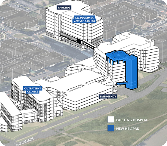
Disaster Recovery
Digital Twin
Education
Rapid Response
Client
QBuild / Department of Education
Location
Caravonica, Queensland, Australia
Project type
Post-Disaster · Reconstruction Mapping
Asset scanned
12,500 sqm
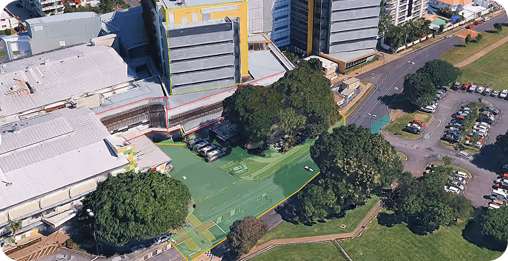
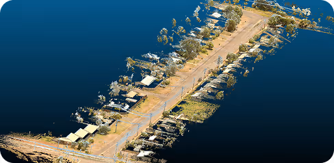
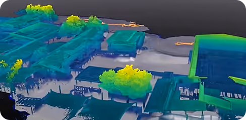
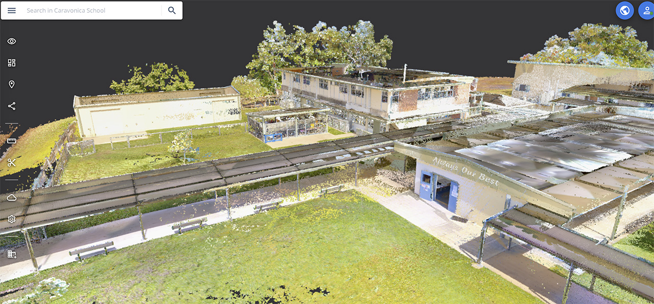
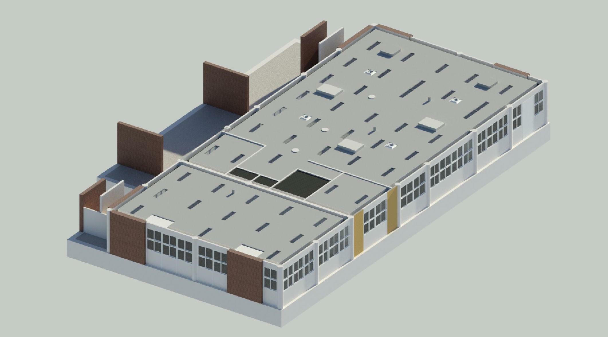
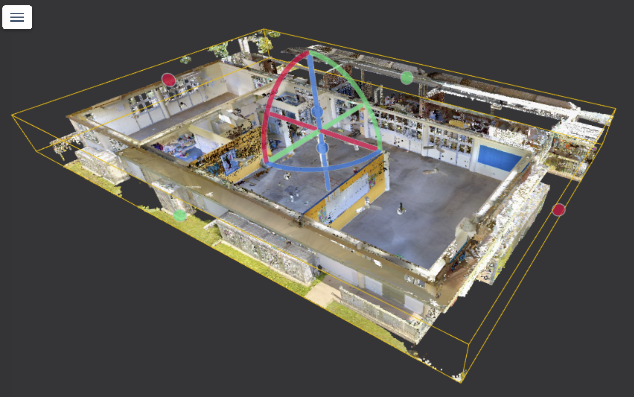
When disaster management was initiated after Cyclone Jasper in 2023, Caravonica State School was able to rebuild quicker after Geo Scan 3D safely entered, scanned the entire campus and created a digital twin.
The school had no floor plans and it would take weeks to collate everything that each classroom had, as well as the locations of whiteboards, data/electrical points and cabinetry, to name just a few. Contractors were on a tight timeline to complete all works before the end of the school holidays.
The reality-captured data created by Geo Scan 3D of all indoor and outdoor spaces was easily shared with stakeholders and third parties and proved to be an invaluable resource in the rebuild process.
The data assisted in controlling variables, reducing cost blowouts, and aided in re-opening the school faster.
The many benefits included but were not limited to:
Geo Scan 3D continues to work with QBuild Cairns to extract further data from the initial scan, as required. This valuable information can be easily accessed by relevant stakeholders right now and into the future.


.png)
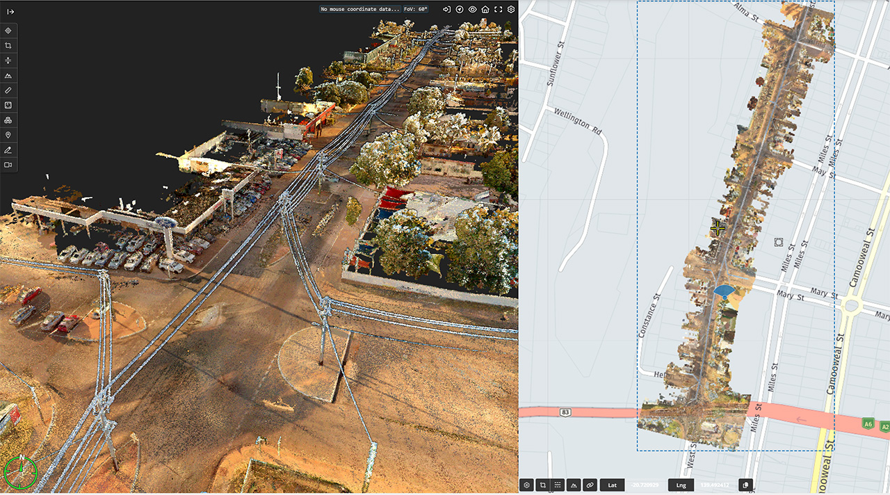
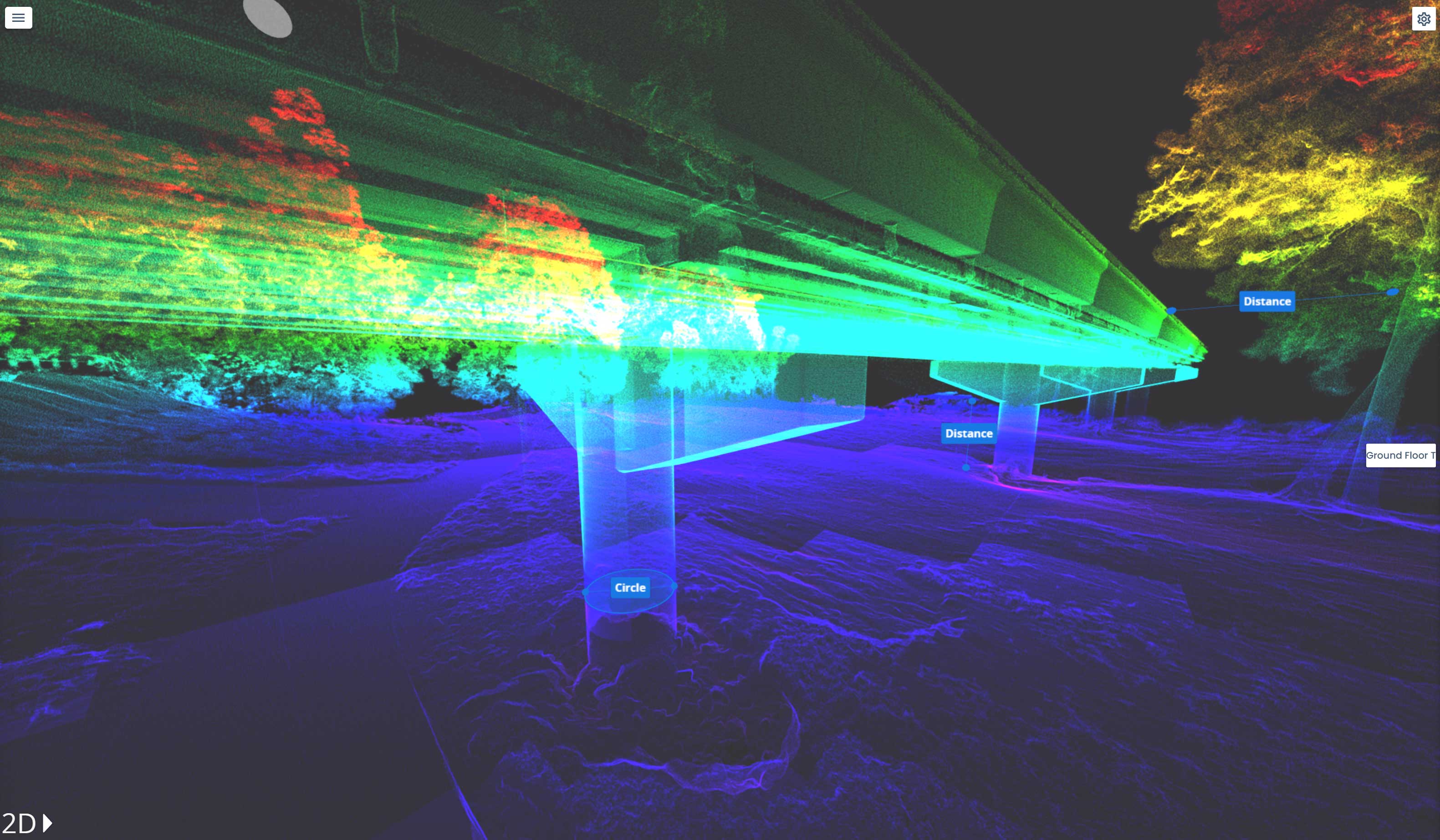
Fast. Accurate. No BS. We fly to your site anywhere in Australia and get the scan done
then deliver web-ready outputs your whole team can use without specialised software.
In a world where speed, precision, and data are critical, at Geo Scan 3D we don't just scan; we take your projects into the digital future. These are the core values that set us apart in the industry:

With our motto "One Scan, Multiple Solutions," we transform a single dataset from your site into numerous outputs such as Digital Twin, 3D Modeling, 2D Floor Plans, and Asset Tracking. This translates to both time and budget savings for our clients.
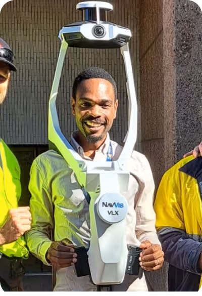
Our team, operating across Australia, is comprised not only of scanning specialists but also includes CASA-certified ReOC commercial drone operators and spatial data experts. We possess all the necessary expertise to conduct the most sensitive and secure operations on time on budget