Digital Twin? Think ‘Google Maps’ for indoor and outdoor spaces.
Revolutionise your sites, facilities and assets and ease the way you work with an interactive and immersive digital twin.
Using the NavVis VLX 3, we can scan and convert reality captured data of indoor and outdoor spaces into a complete and comprehensive digital twin that provides visual excellence, and can be easily stored, accessed and shared from the comfort of your office.
Envisage working with a digital twin of your sites, facilities and assets to ease your workload, enhance smart collaboration and amplify confident decision-making.


Bring next-generation location experiences and insights to your workplace.
Create an interactive and connected experience for onsite and off-site smart collaboration, staff onboarding and visitor experiences with wayfinding - indoor navigation that has real time location analytics, is accessible across devices and can easily integrate with third-party systems.
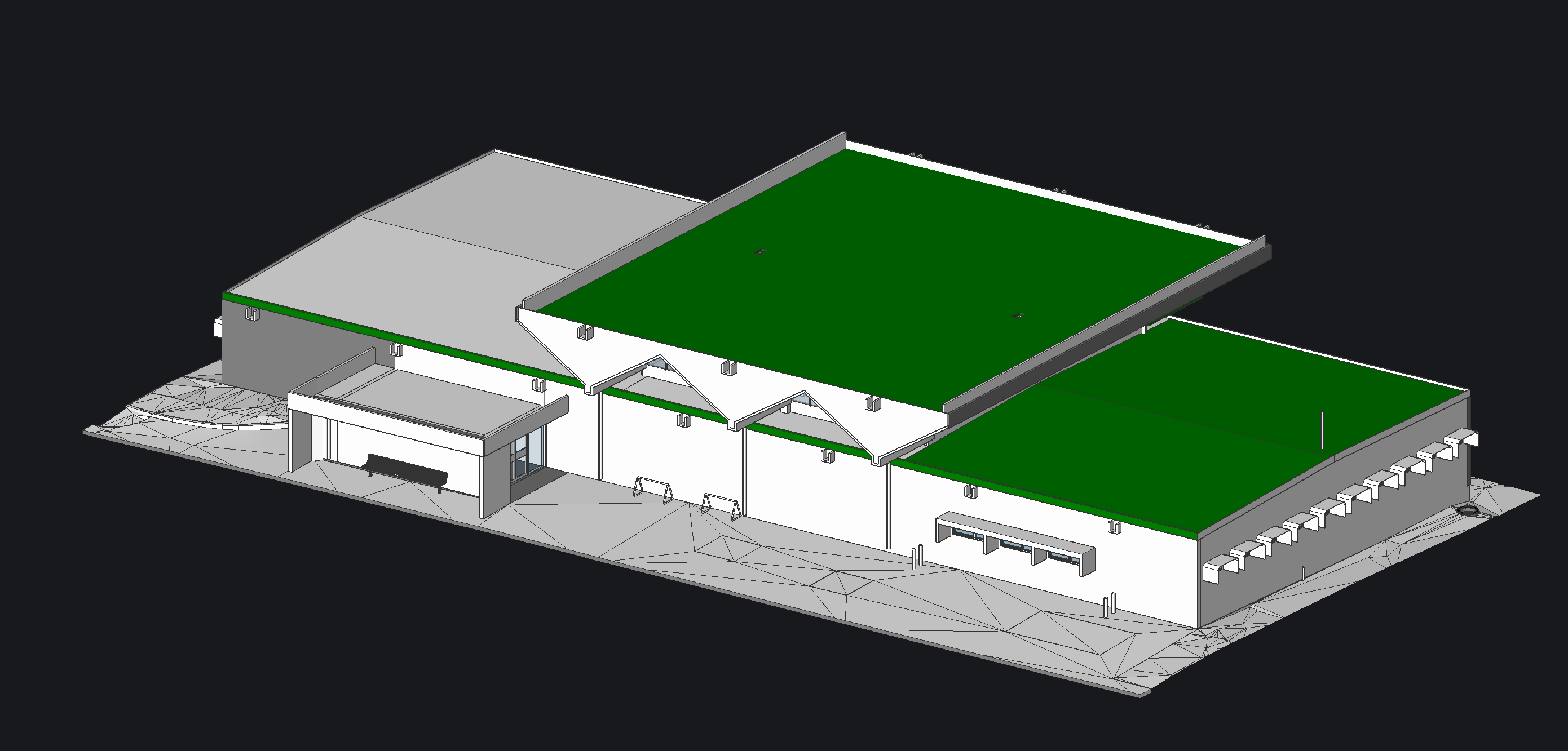
Geo Scan 3D is a leader in 3D modelling, providing superior scans and levels of development to meet a range of requirements across industries.
The higher the level of development requested by the client the greater the level of detail the 3D modelling scan can provide about an object/asset, which may include brand, model number, exact materials, structural information, cost, and energy rating to name just a few.
3D Modelling adds depth dimension, detail, accuracy, and offers unparalleled quality, providing complete and comprehensive information that can be easily stored, accessed and shared from any device and any location.
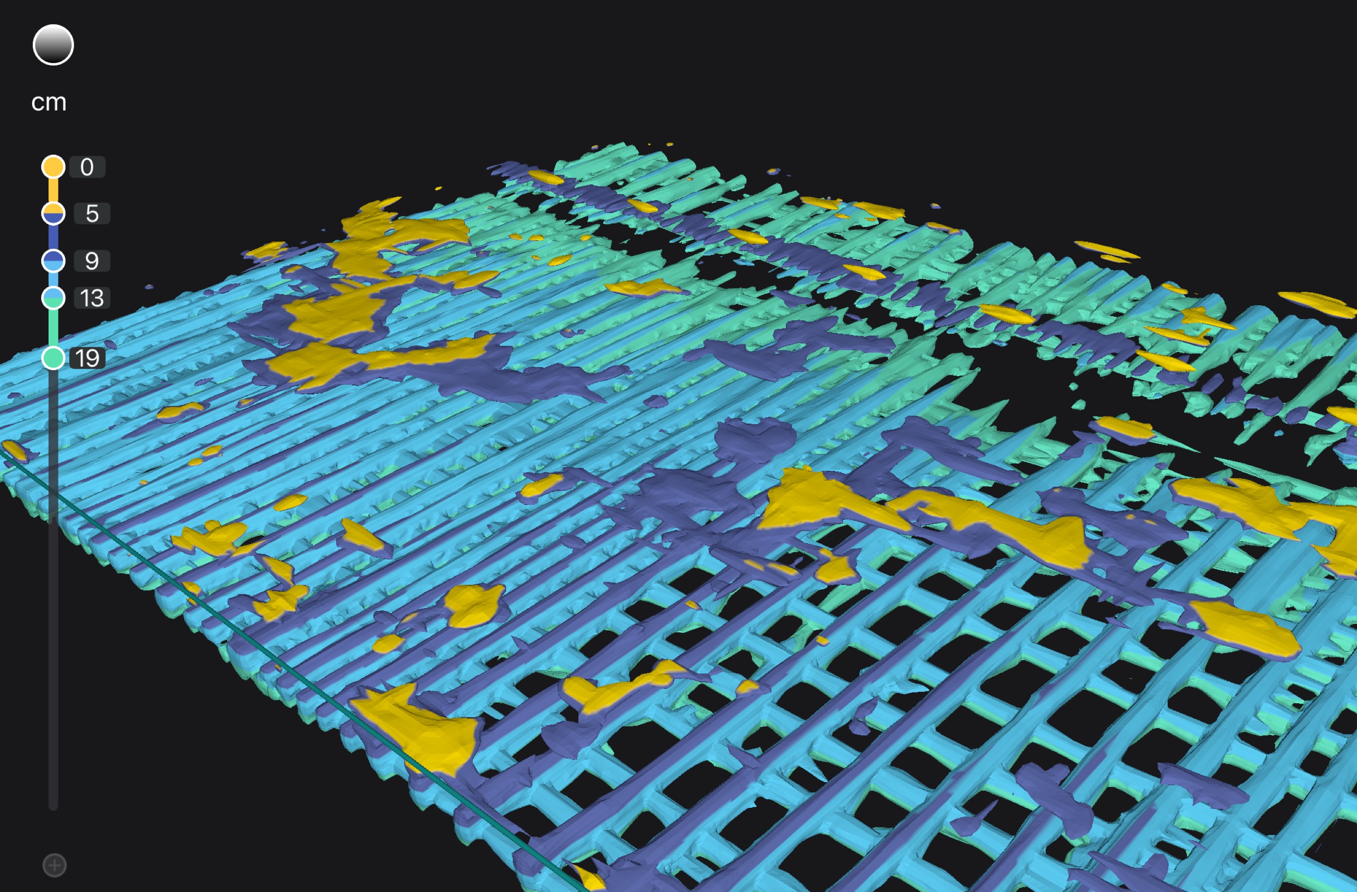
Sub surface scanning (GPR) for delamination of concrete slabs. Rebar location etc
This same technology is also well suited to LiDAR (Light Detection has become indispensable to modern archaeology.
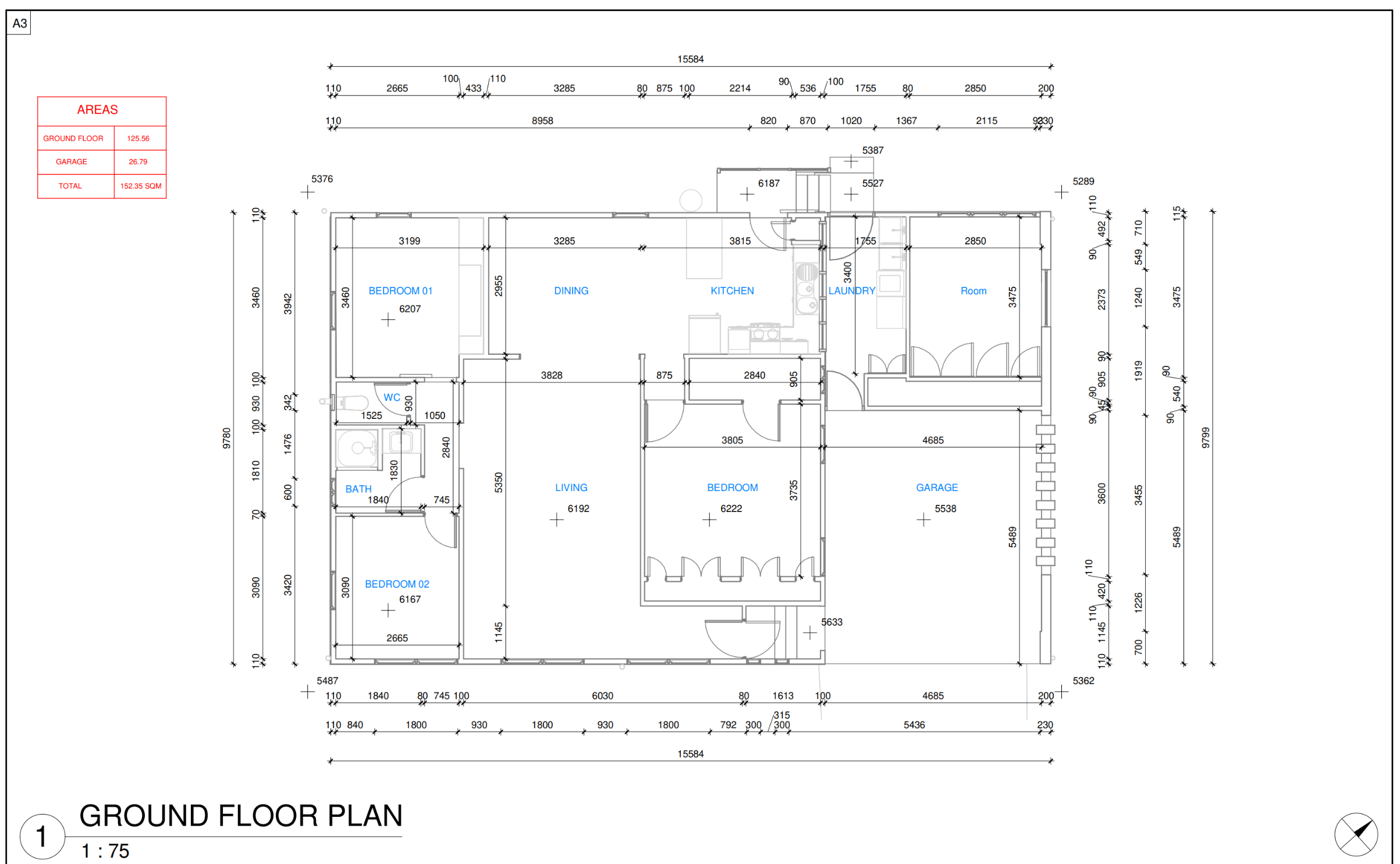
From reality captured data, Geo Scan 3D can create 2D floor plans of your building and facilities.
2D floor plans provide flat straightforward representation of a property's layout. The plans can show top-down 3D views and side views of a building, including walls, doors, fixtures, etc.
The floor plans have a wide range of benefits and applications, providing a clear visualisation aid to assist with planning, construction guidance, rebuilds, error reduction, and shows the property flow.
Our plans are clear, accurate, cost-effective and can be easily stored, accessed, and shared from the comfort of your office.
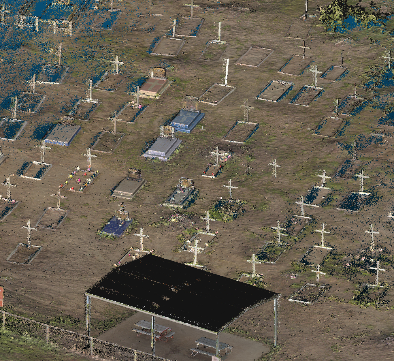
From reality captured data, Geo Scan 3D can create 3D models of sites-Tree's or whole towns. Imagine one billion survey grade points every 15 minutes of scanning
3D models provide real-life representation of a sites layout. The plans can show top-down 3D views and side views of a cemetry, sacret site, or Asetss of historical significance
The Lidar Scans have a wide range of benefits and applications, providing a clear visualisation aid to assist with cultural learning, retaining
Our Lidar scans are clear, accurate, cost-effective and can be easily stored, accessed, and shared from anywhere-Right is a lidar scan from Aurukun 2024
Geo Scan 3D can assist you in tracking assets by combining location and asset data to create a comprehensive operating picture across your organisation.
Knowing your asset conditions, locations, and history will increase efficiency from maintenance to capital planning, and enable you to make informed decisions with accuracy and confidence.
We provide a key service for all industries that require assets to be tracked and condition assessment reports to be completed.
Geo Scan 3D can survey rough terrain and turn the reality captured data into seamlessly crafted mapping that achieves visual excellence far beyond drones.
We can seamlessly capture:

The NavVis VLX 3 with advanced light detection and ranging (LiDAR) and SLAM technology produces a high degree of detail and superior digital terrain models (DTM) compared to photogrammetry.
Geo Scan 3D produces first-class deliverables as our scanner can easily penetrate dense vegetation and captures the ground surface, even under thick canopies.
